
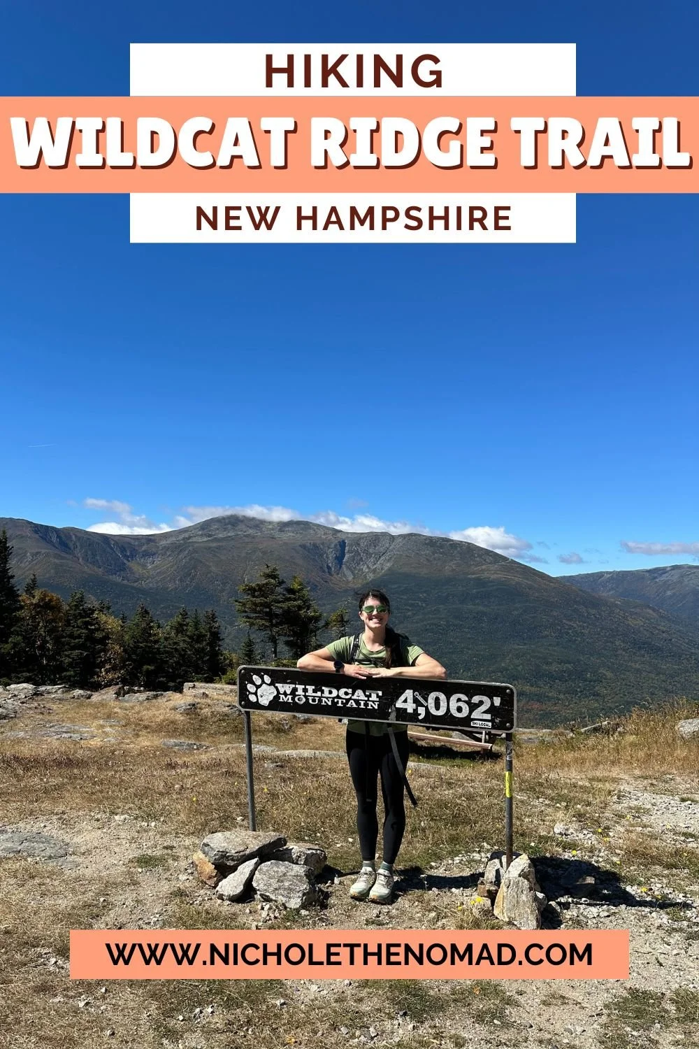
Wildcat D and A via Wildcat Ridge Trail
Disclaimer: This post contains affiliate links. If you click through and make a purchase, my blog may receive a commission at no additional cost to you.
Wildcat Ridge Trail Overview
Wildcat Ridge Trail is the most popular route to Wildcat Mountain, which has five peaks, although only two are on the New Hampshire 4,000 Footer List: Wildcat D and Wildcat A. It is also the steepest mile on the Appalachian Trail, gaining over 2,000 feet of elevation in under 1.5 miles, with 1,000 feet of that in the first half-mile. Because it is incredibly steep, most hikers ascend via Wildcat Ridge Trail and descend via Polecat Ski Trail.
Trail Details
Trail: Wildcat Ridge Trail > Polecat Ski Trail
Length: 8 miles
Elevation Gain: 3,600 feet
My Trail Time: 5 hours hiking; 6 hours total
Hike Overview
NOTE: To hike up Wildcat Ski Trail and down Polecat, you need a car spot, or you can hike along the road, then on Lost Pond Trail back to the Glen Ellis Scenic Area.
Wildcat Ridge Trail is incredibly steep, landing it on the New Hampshire Terrifying 25 List. The first half-mile gains over 1,000 feet of elevation, with a few rock scrambling sections.
Because it is a steep trail, most hikers ascend Wildcat Ridge Trail to Wildcat D and A, and then descend via the Polecat Ski Trail. The ski trail is a much easier descent, and honestly, I would not descend Wildcat Ridge Trail.
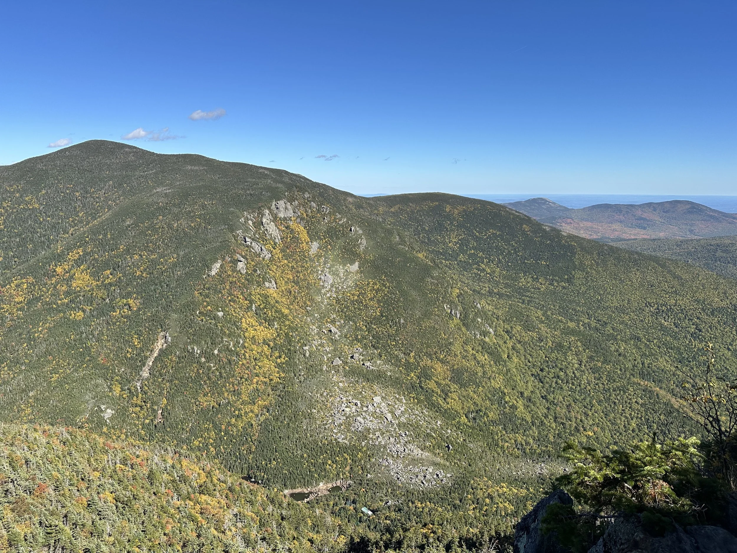
After Wildcat Ridge Trail reaches the top of Wildcat Mountain Ski Area, the rest of it is a lot less steep as it travels over Wildcat D, C, B, and A. Although Wildcat Mountain has five peaks, only two are on the New Hampshire 4,000 Footer List because they have 200 feet of prominence: Wildcat D and Wildcat A. Both have stunning views overlooking the surrounding mountains.
Looking to track your hikes while completing the New Hampshire 4,000 Footer List?
Whether this is your first or tenth time completing the list, this journal is designed to help you track, reflect, and celebrate each summit!
Each journal includes:
- individual pages for each mountain
- space to log stats about the hike
- sections to journal about your favorite moments
- completion tracker to celebrate your progress
- and fun extras like Hiking Bingo!

Wildcat D and A via Wildcat Ridge Trail Guide
September 19, 2025
We decided to start the Fall off with a bang by hiking the iconic Wildcat Ridge Trail. I hiked it a few years ago along the Wildcat-Carter-Moriah Traverse and knew I wanted to hike it again, so I was very excited when my friend said she wanted to finally hike it!
We arrived at 10:30 am on a Friday at the newly opened Glen Ellis Scenic Area, which now requires a parking fee. We were one of only a handful of cars, but on weekends, I can only imagine how packed the parking lot is.
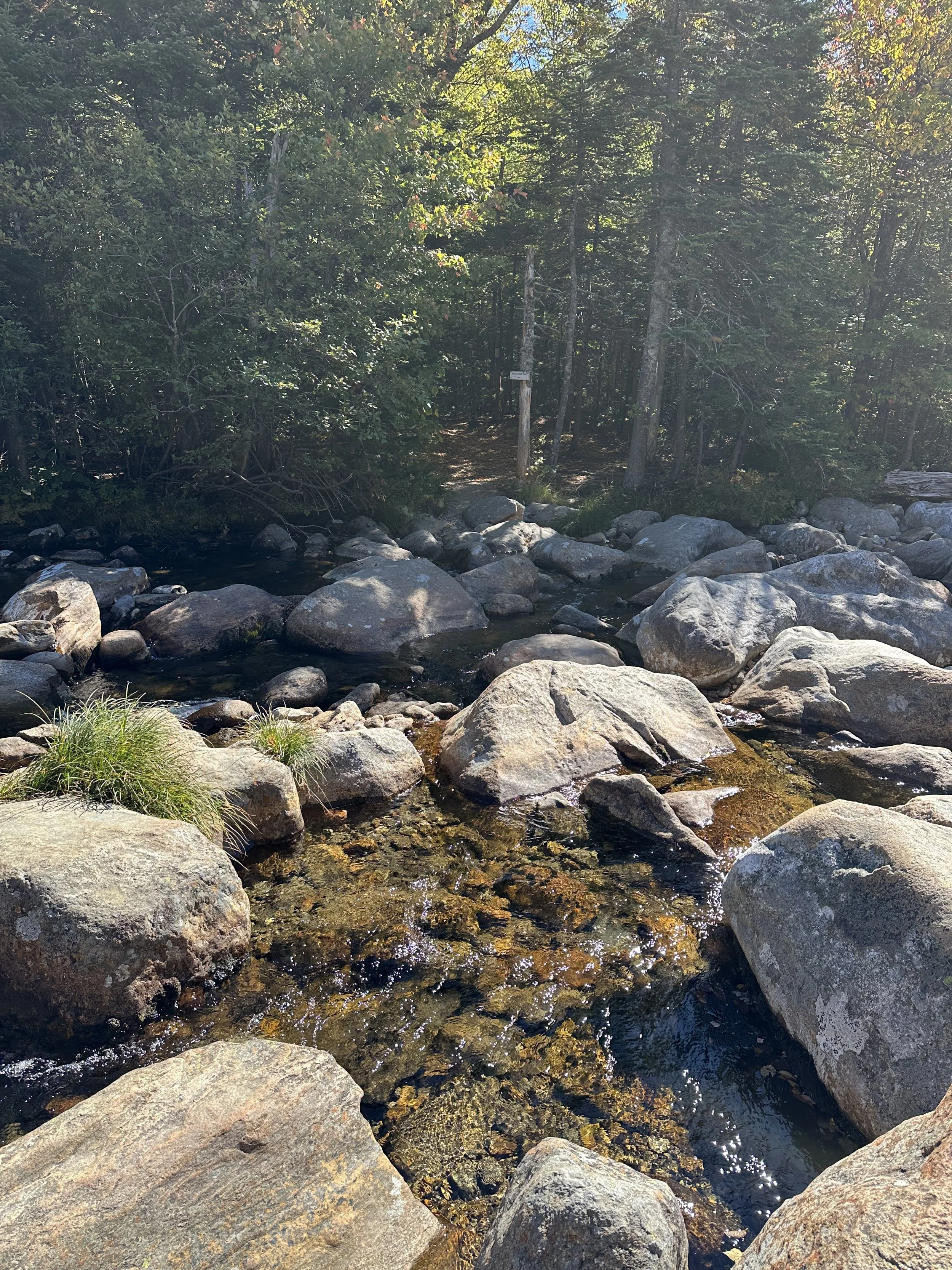
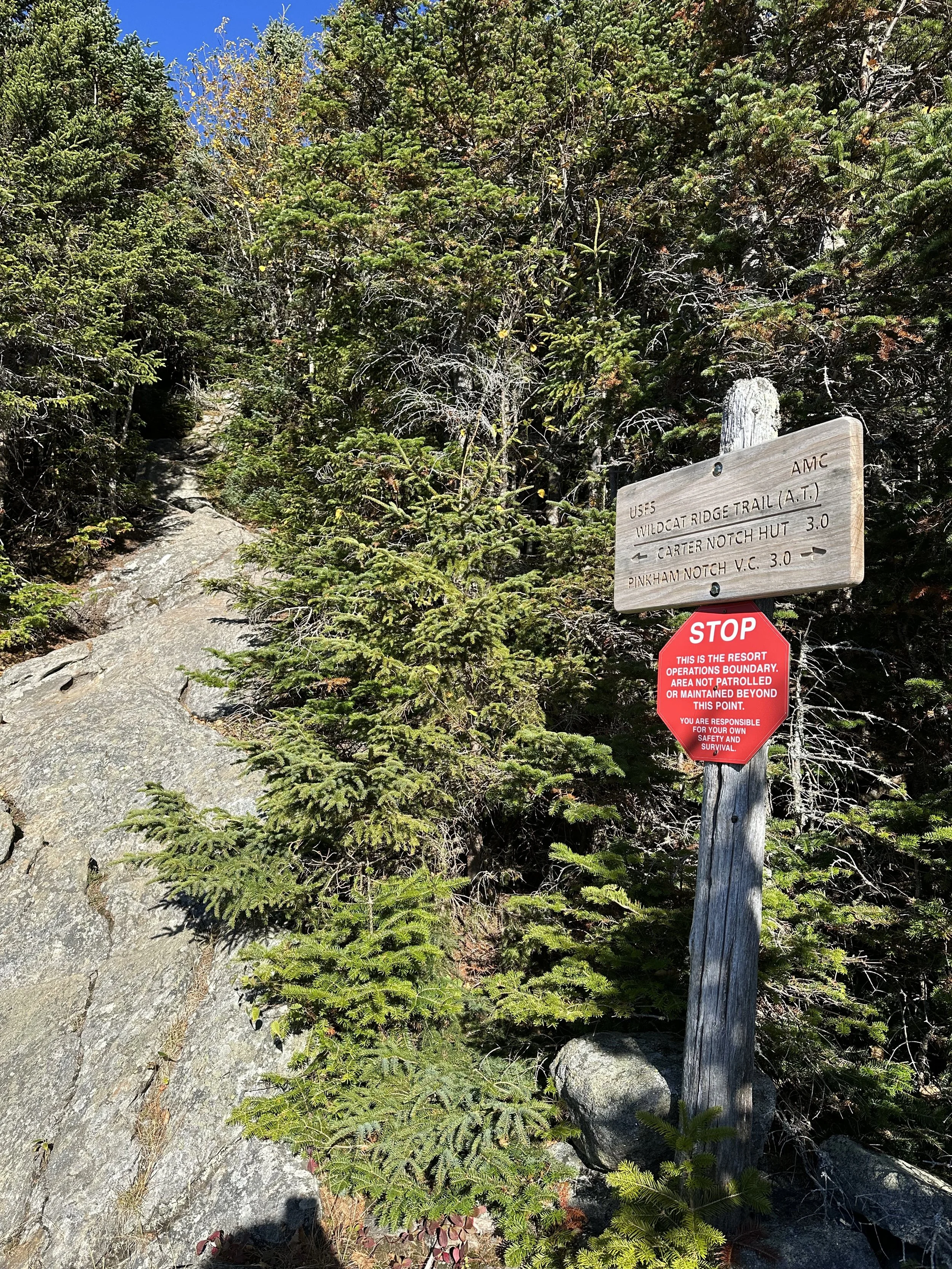
The trail traveled under the road before turning left and heading down to the Ellis River. We were lucky to hike this during a drought because I heard this is one of the toughest river crossings. We did not have any issues because the water was so low, but I could see why it would be tough when the water is higher. If the water is high, you could start at Joe Dodge Lodge and hike Lost Pond Trail to Wildcat Ridge Trail to skip the river crossing.
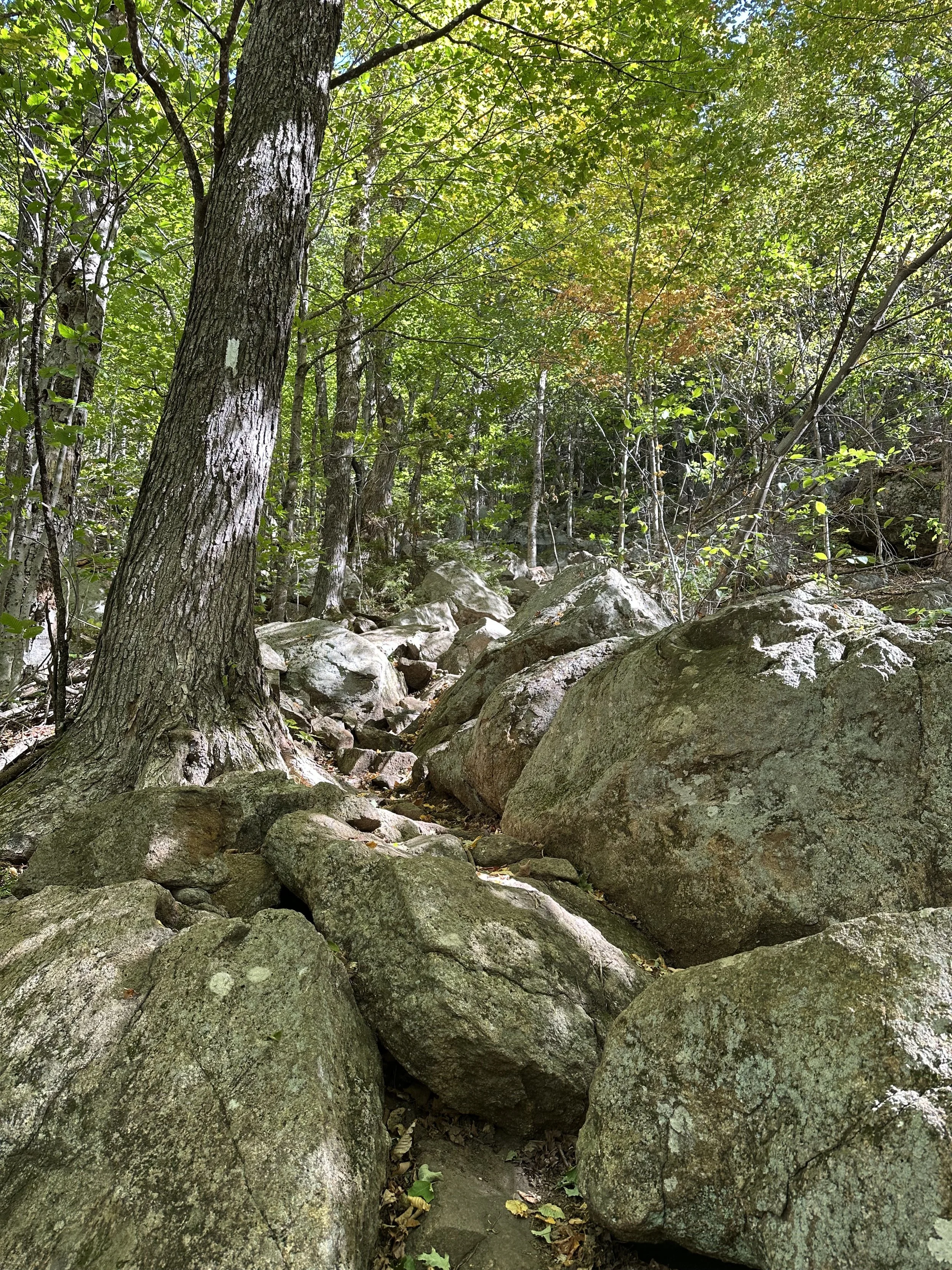
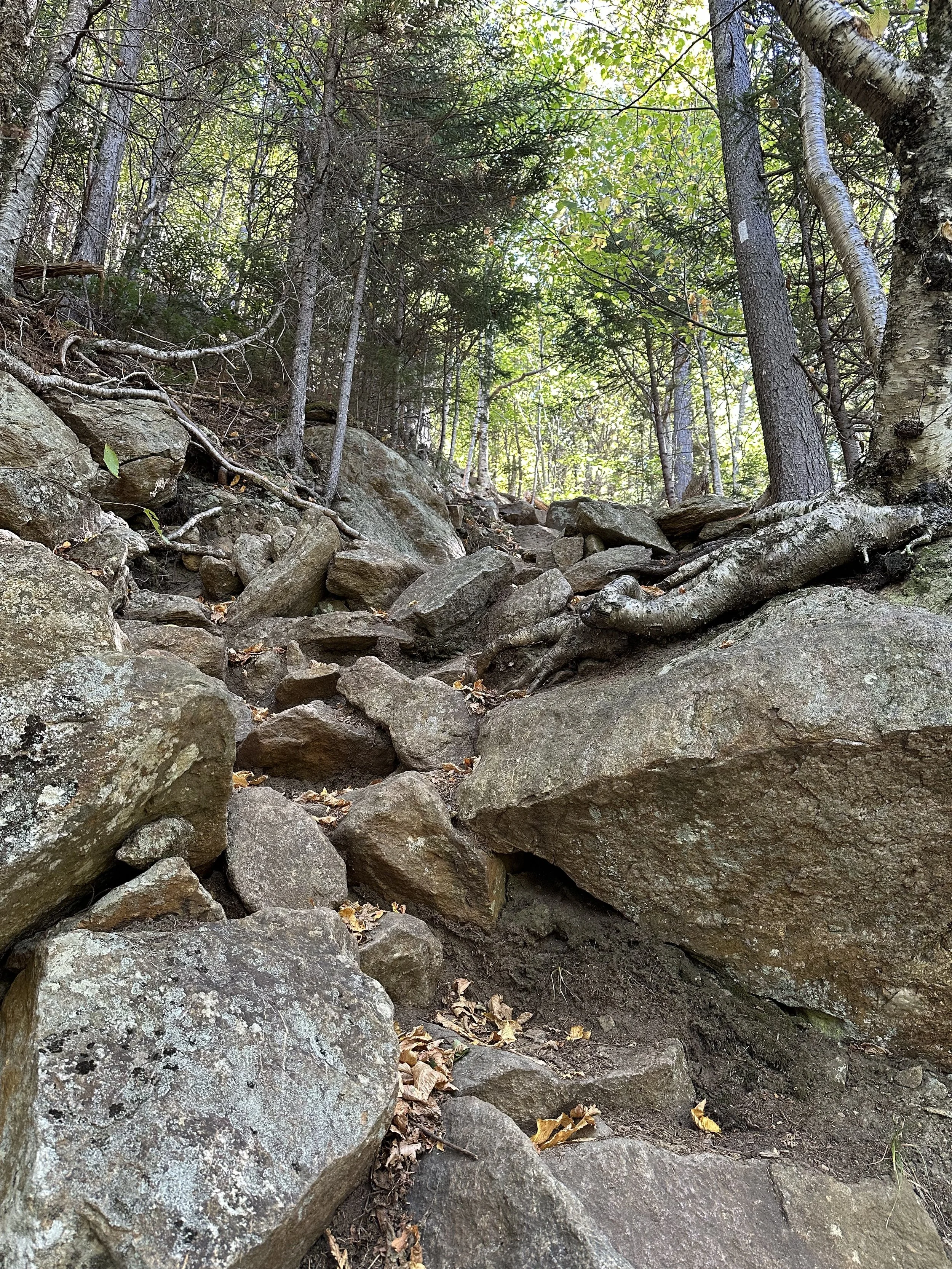
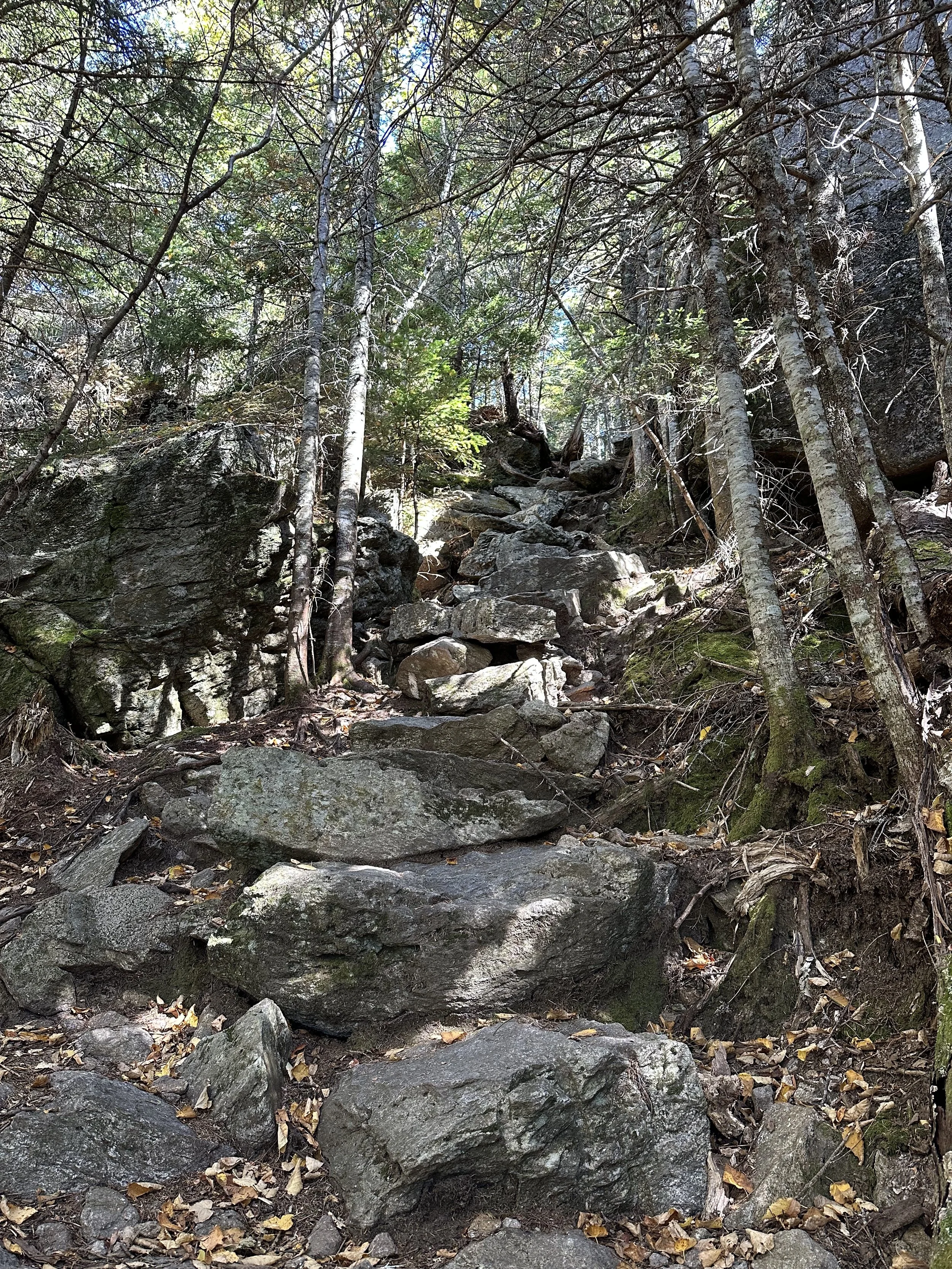
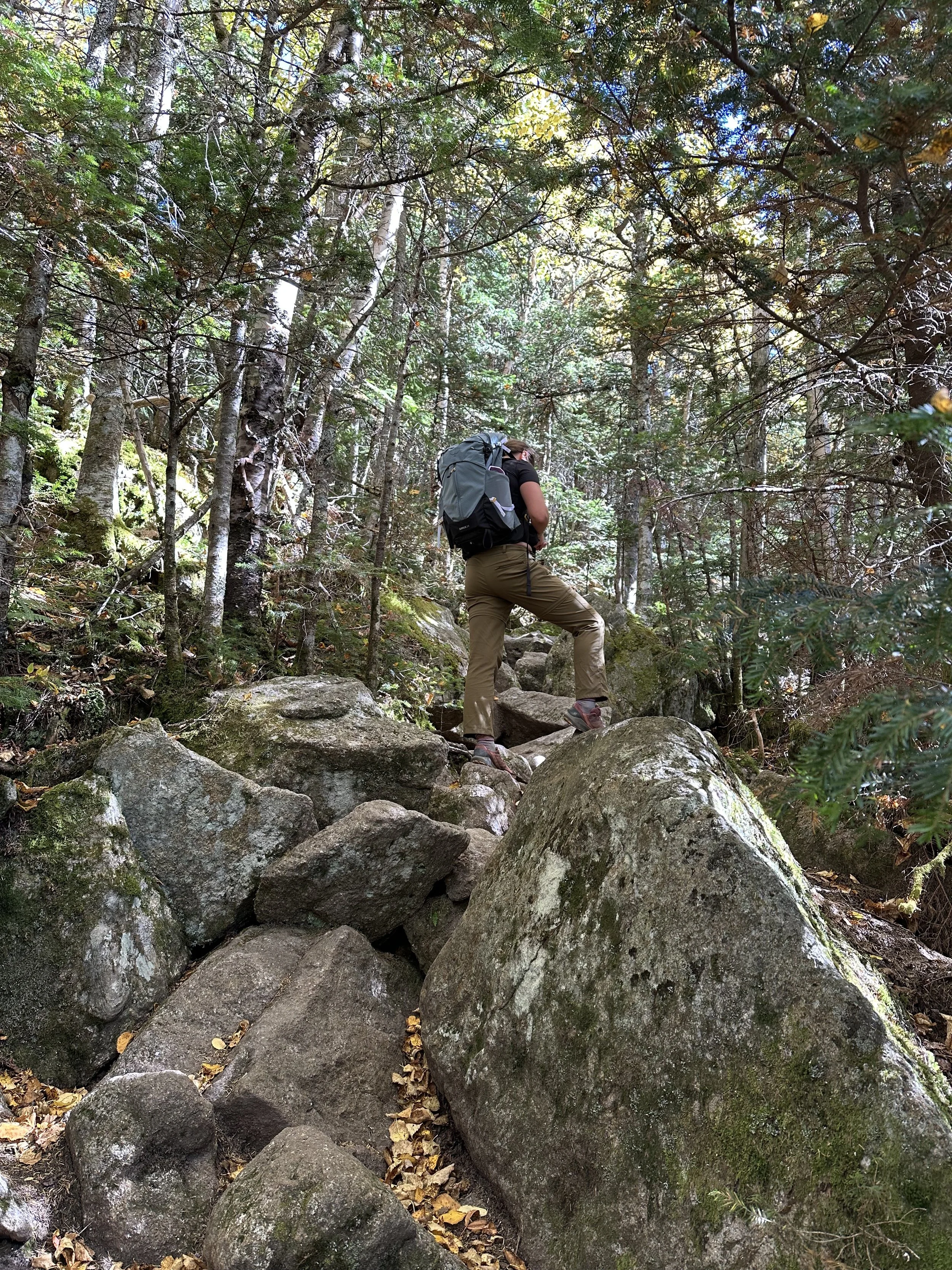
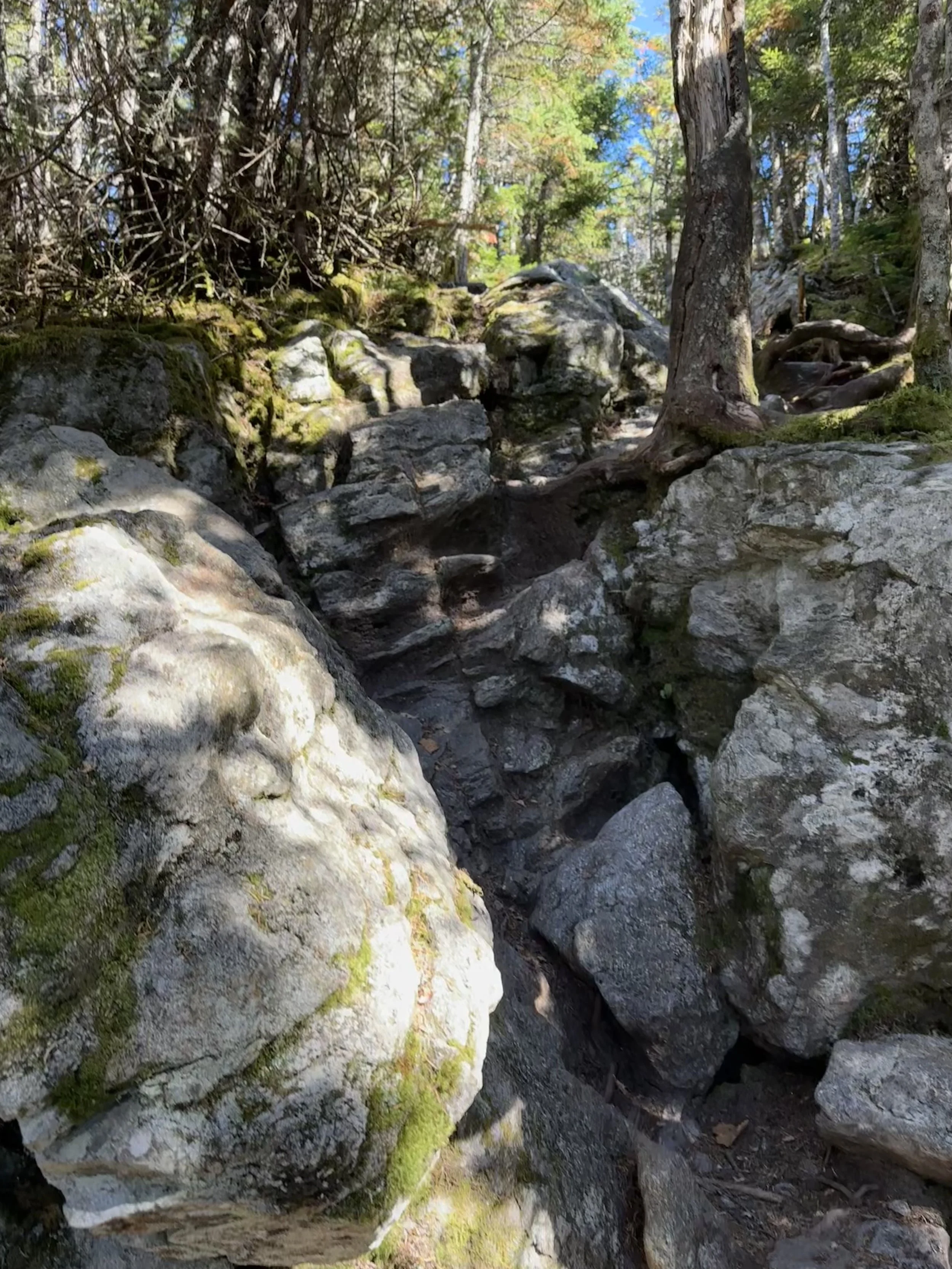
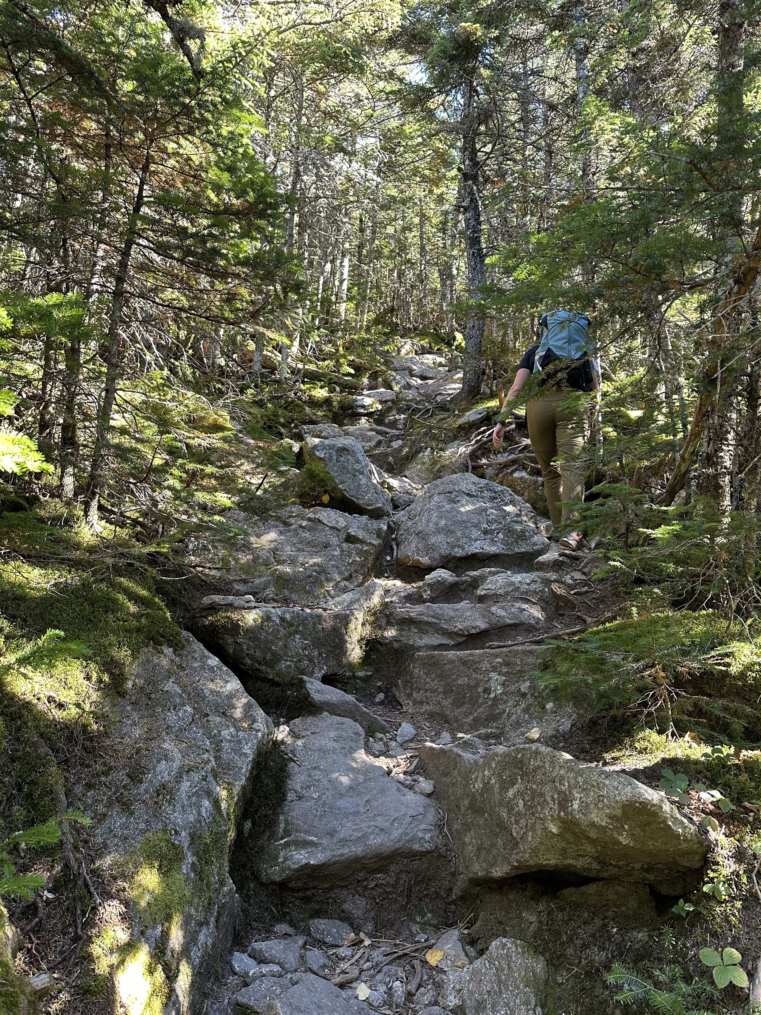
Once we crossed, the Wildcat Ridge Trail immediately began to climb steeply, so we did not get a warm-up. This section gained about 1,000 feet in a half-mile, and let me tell you, it made my legs burn, haha.
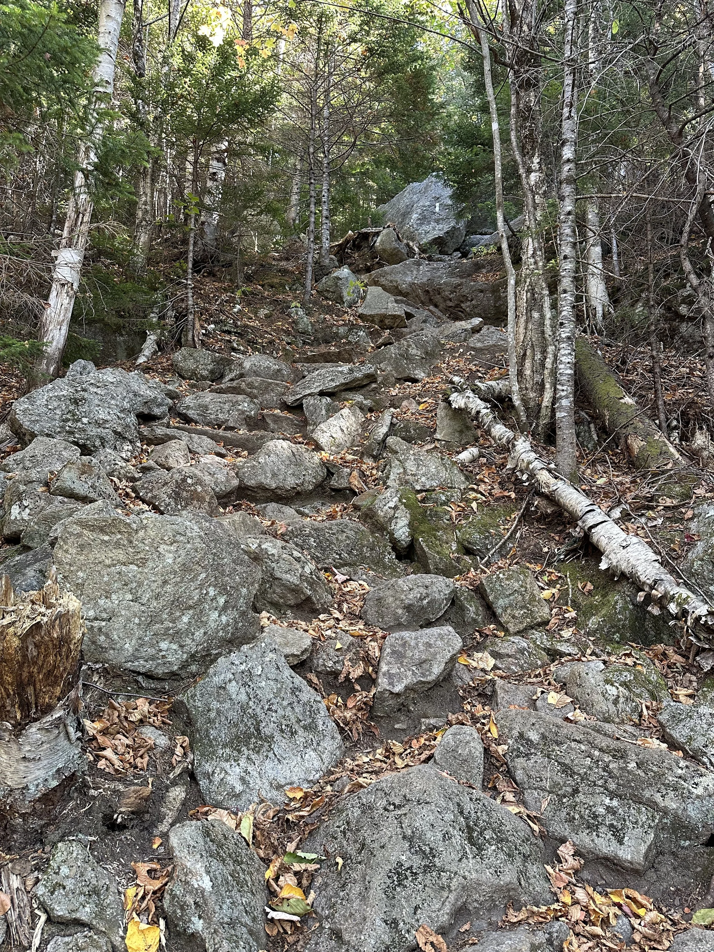
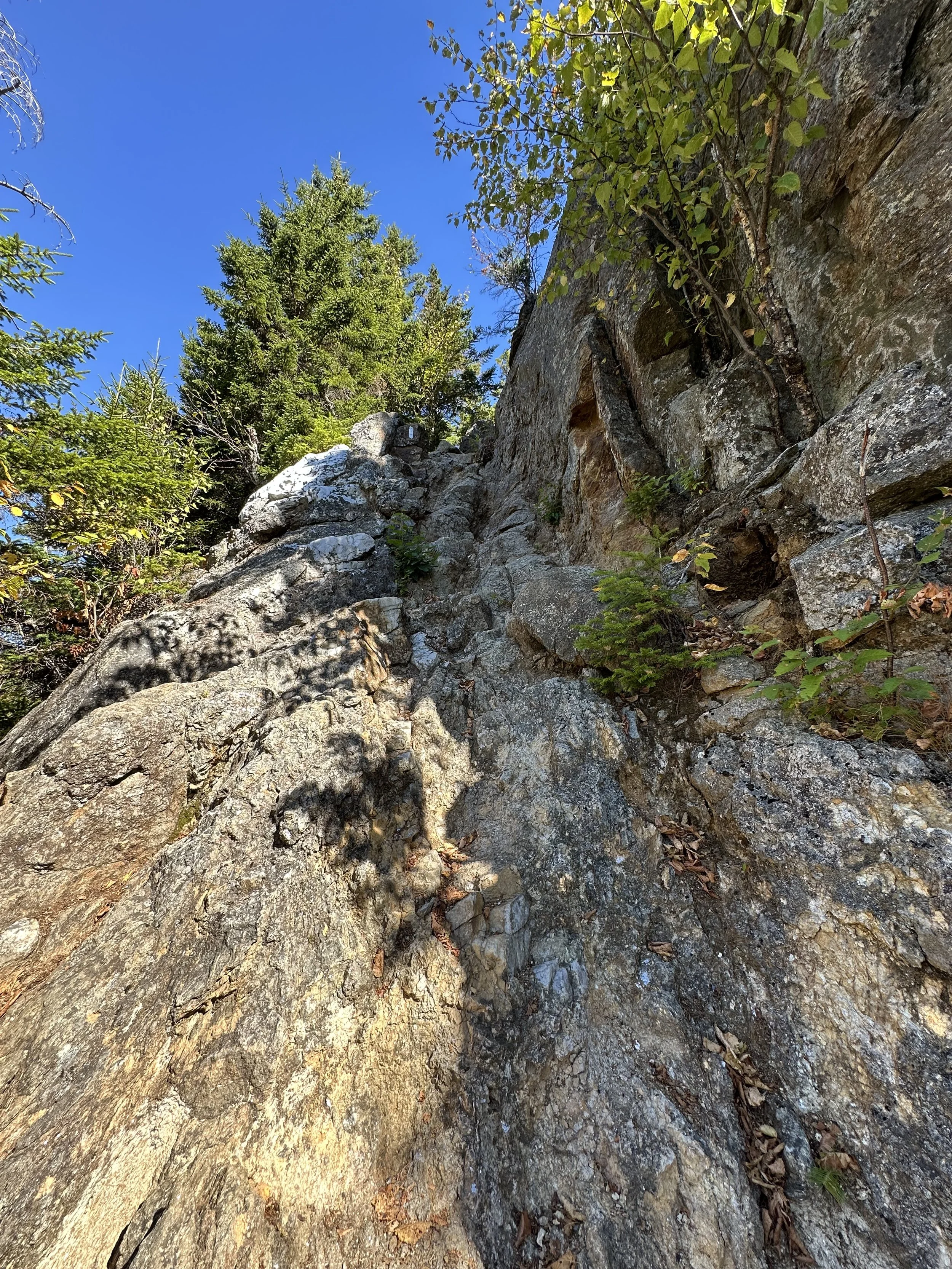
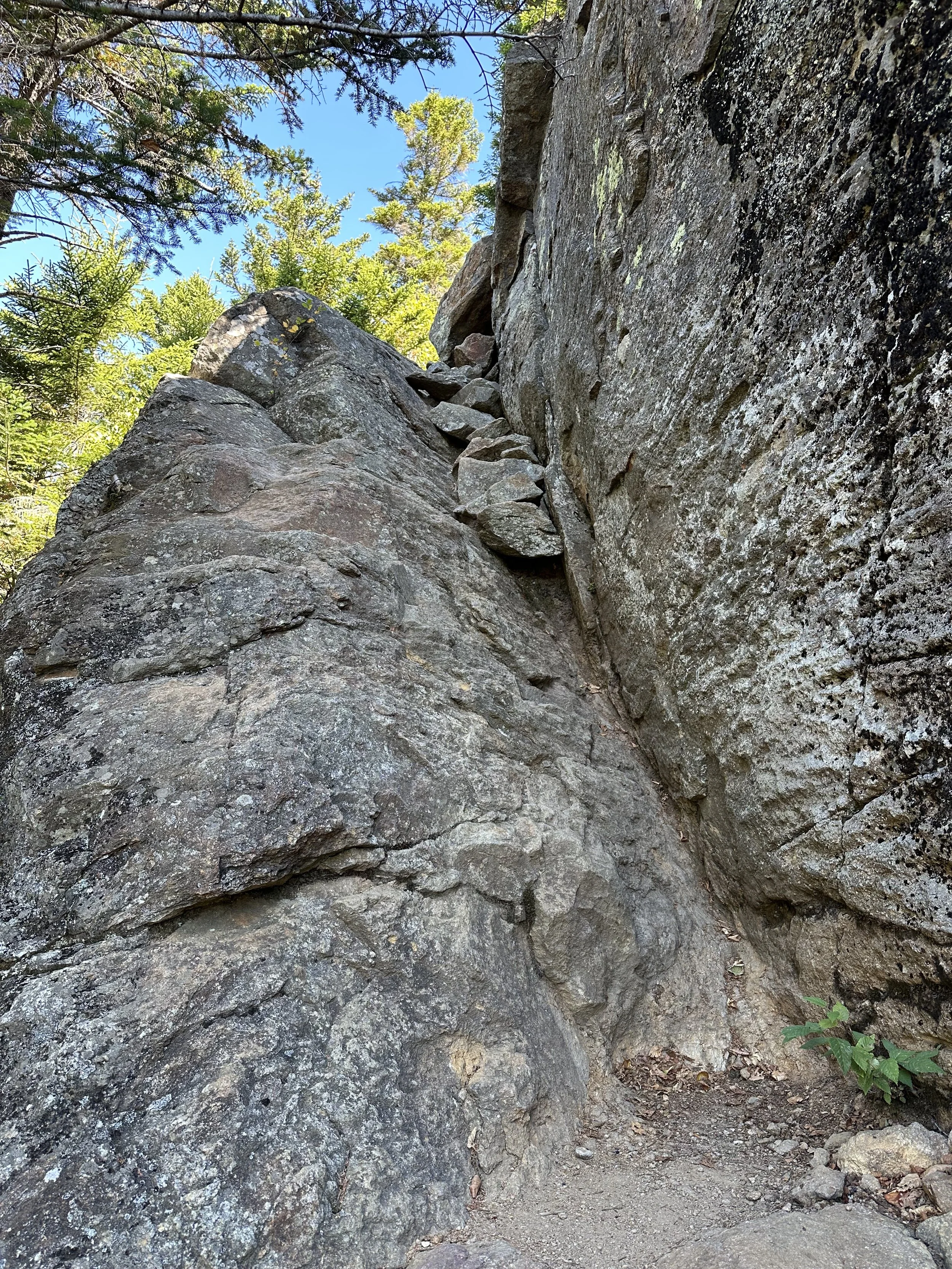
And before we knew it, we arrived at the two terrifying sections along the trail. Both sections, in my opinion, were not too bad. The trail has a pretty steep drop-off on one side, but the rock scrambles have plenty of hand and foot holds that I never felt unsafe. And if you love rock scrambling like me, you will love these few sections!
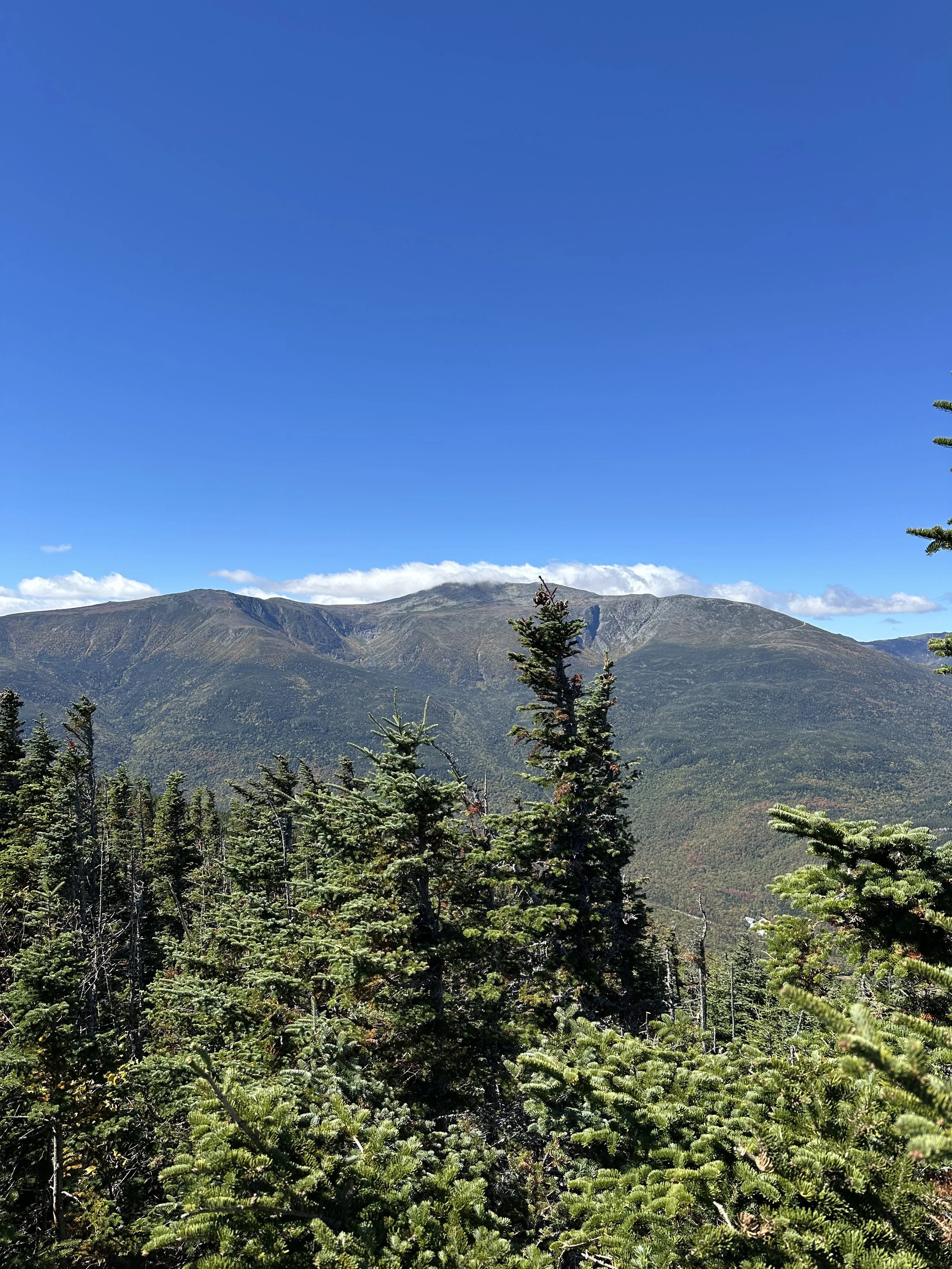
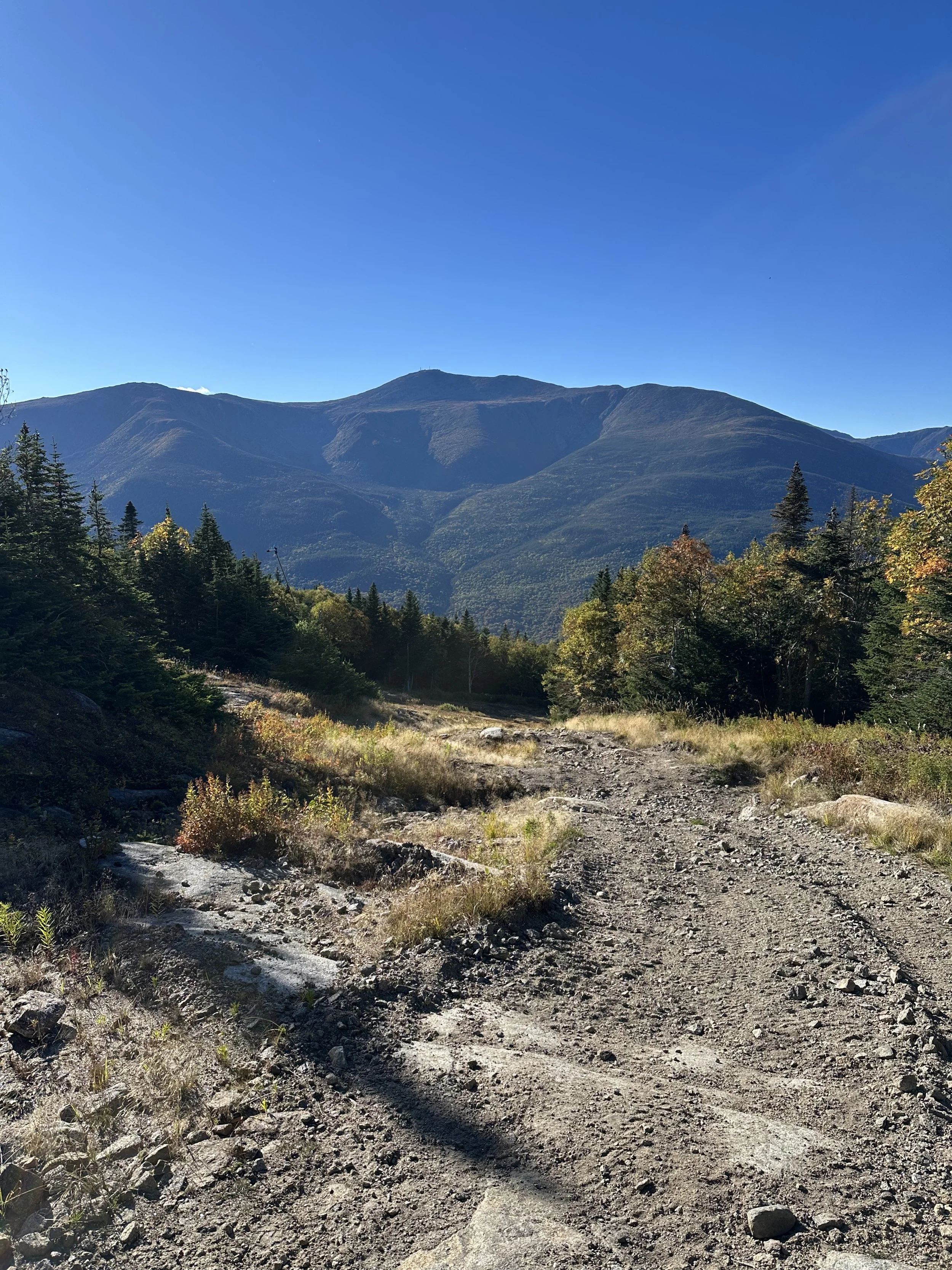
Once we reached the top of this steep section, we had stunning views looking across the notch towards Mount Washington. It was a nice reward for the steep trail we just conquered!

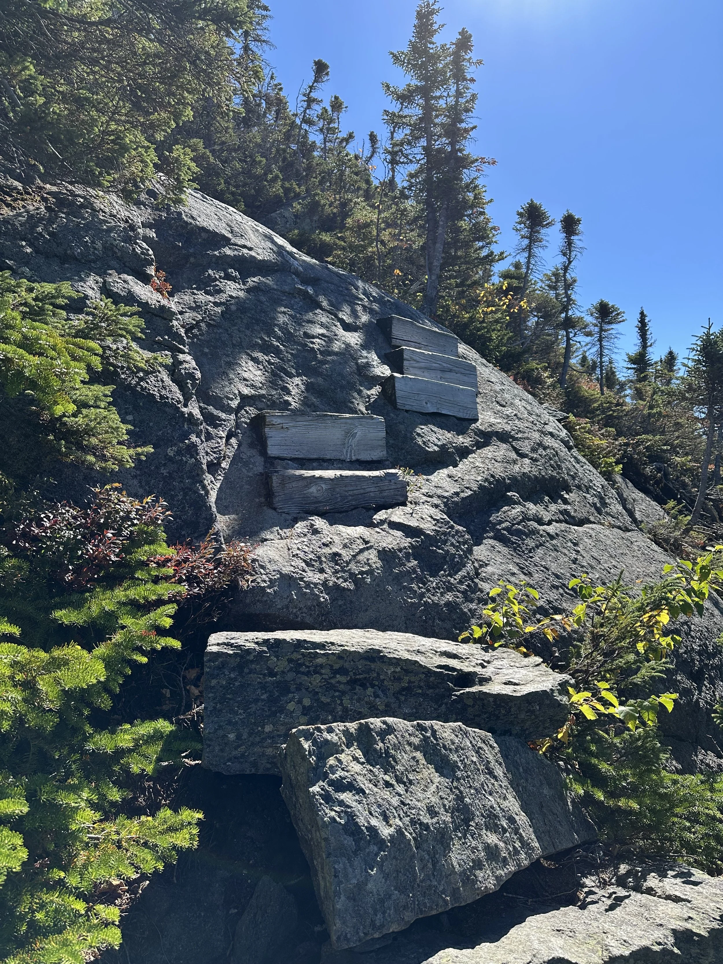
The rest of the trail leading to the top of Wildcat Mountain Ski Area was steep and relentless, and in a few areas we had to use our hands, but it was fun! And just before the top, a few sections had stairs on rock faces. I love this type of stuff, and I thought it was so fun. And of course, it made the climb a bit easier with the stairs.
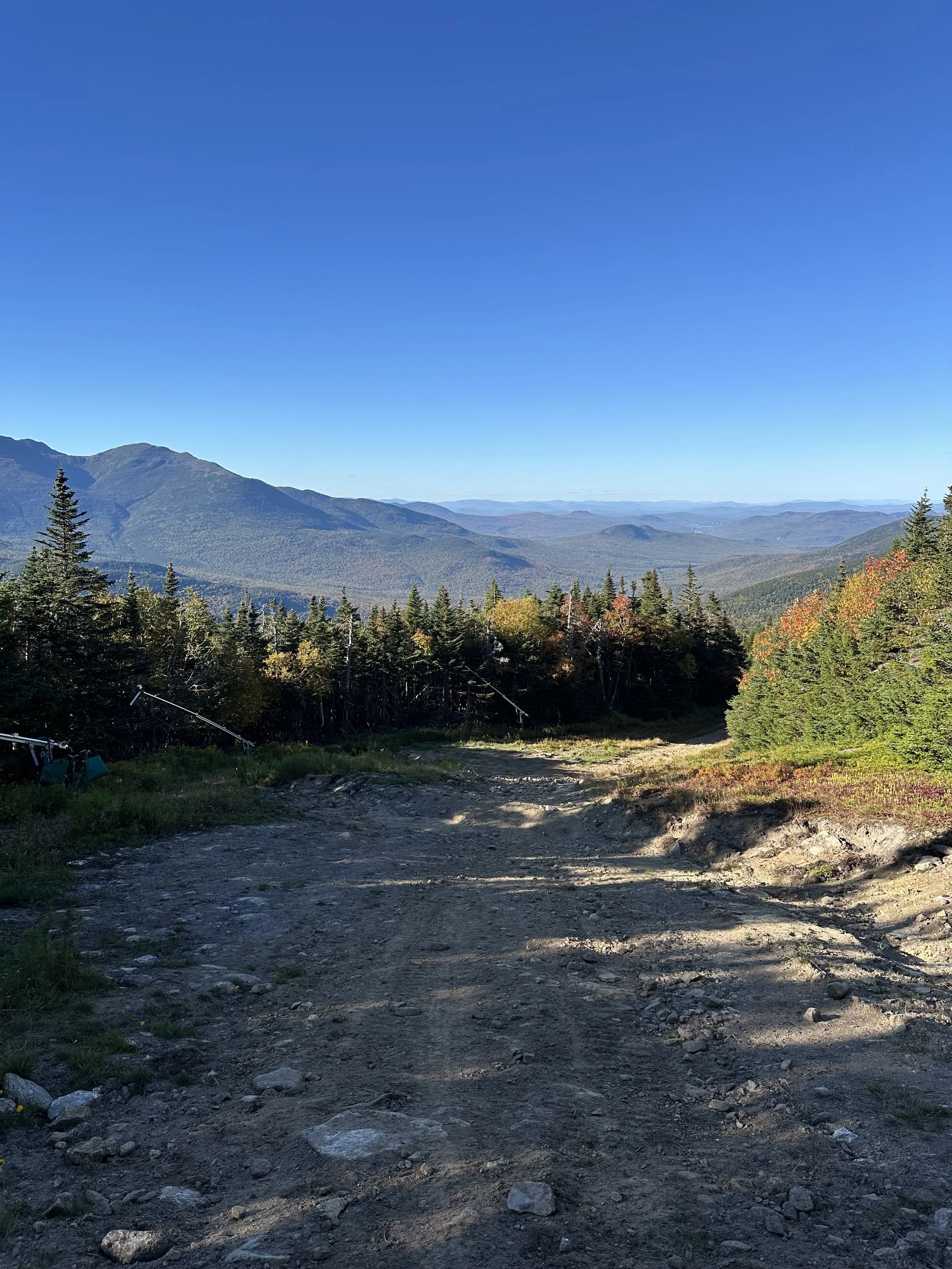
The top of Wildcat Mountain Ski Area offered breathtaking views of Mount Washington and the surrounding mountains. We took a break here to enjoy a snack and add a layer as the wind picked up.
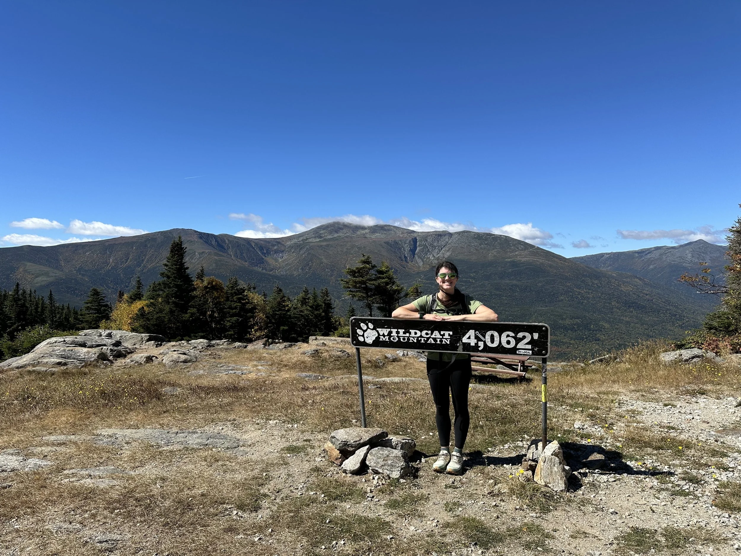
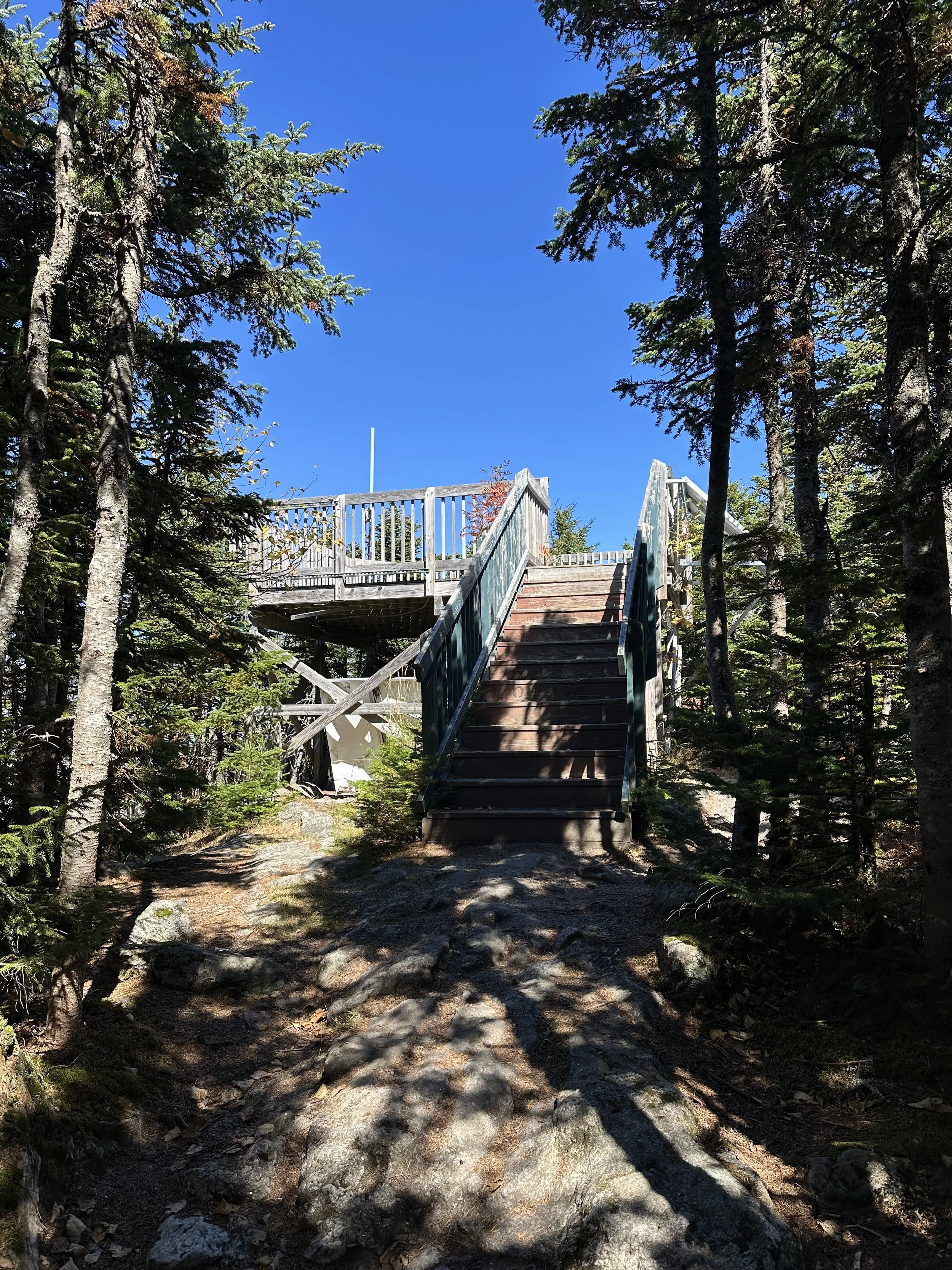
Wildcat Ridge Trail to Wildcat D continued behind the small building and ascended steeply for the next 0.1 miles. Wildcat D had a viewing platform on its summit, which gave us more views of Mount Washington.
We originally only planned to hike to Wildcat D, but decided to continue to Wildcat A because we were already up there, and why not, haha. We had enough food and water, and my friend needed Wildcat A for her grid, so we sent it!
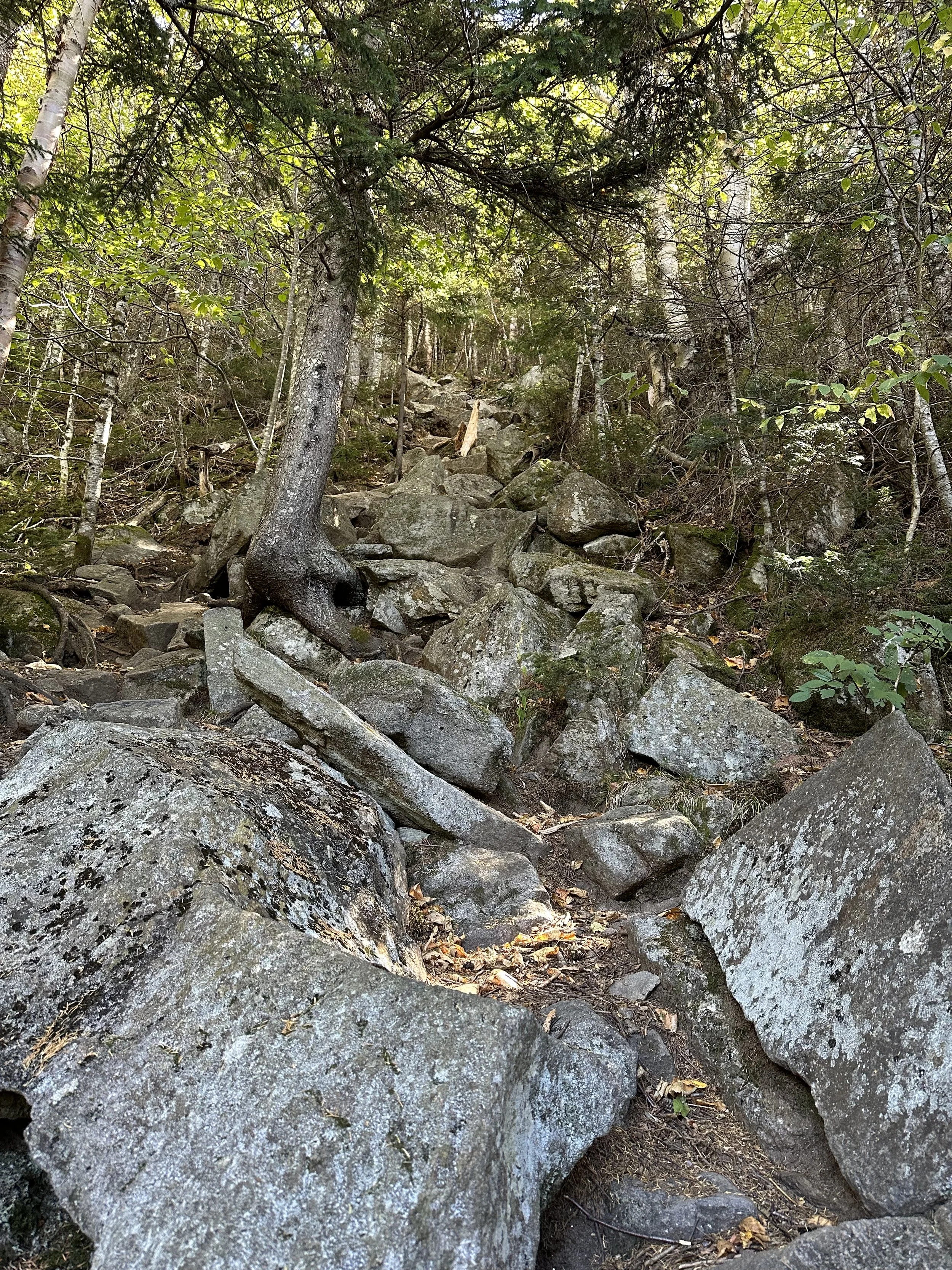
The rest of the Wildcat Ridge Trail from Wildcat D to Wildcat A had a lot of ups and downs, literally. The trail would ascend, then descend, then ascend, then descend. You get the picture. Some of the sections were pretty steep, but we were yapping a lot, so it flew by, haha.
The trail immediately descended steeply off Wildcat D before slowly beginning to ascend towards Wildcat C for the next mile. Wildcat C did not have any views, and we would have honestly missed it were we not using our map.
Wildcat B was only a half-mile from Wildcat C, and we flew along the trail and arrived before we knew it. It was another summit without any views, so we did not spend long on it before continuing to the final peak.
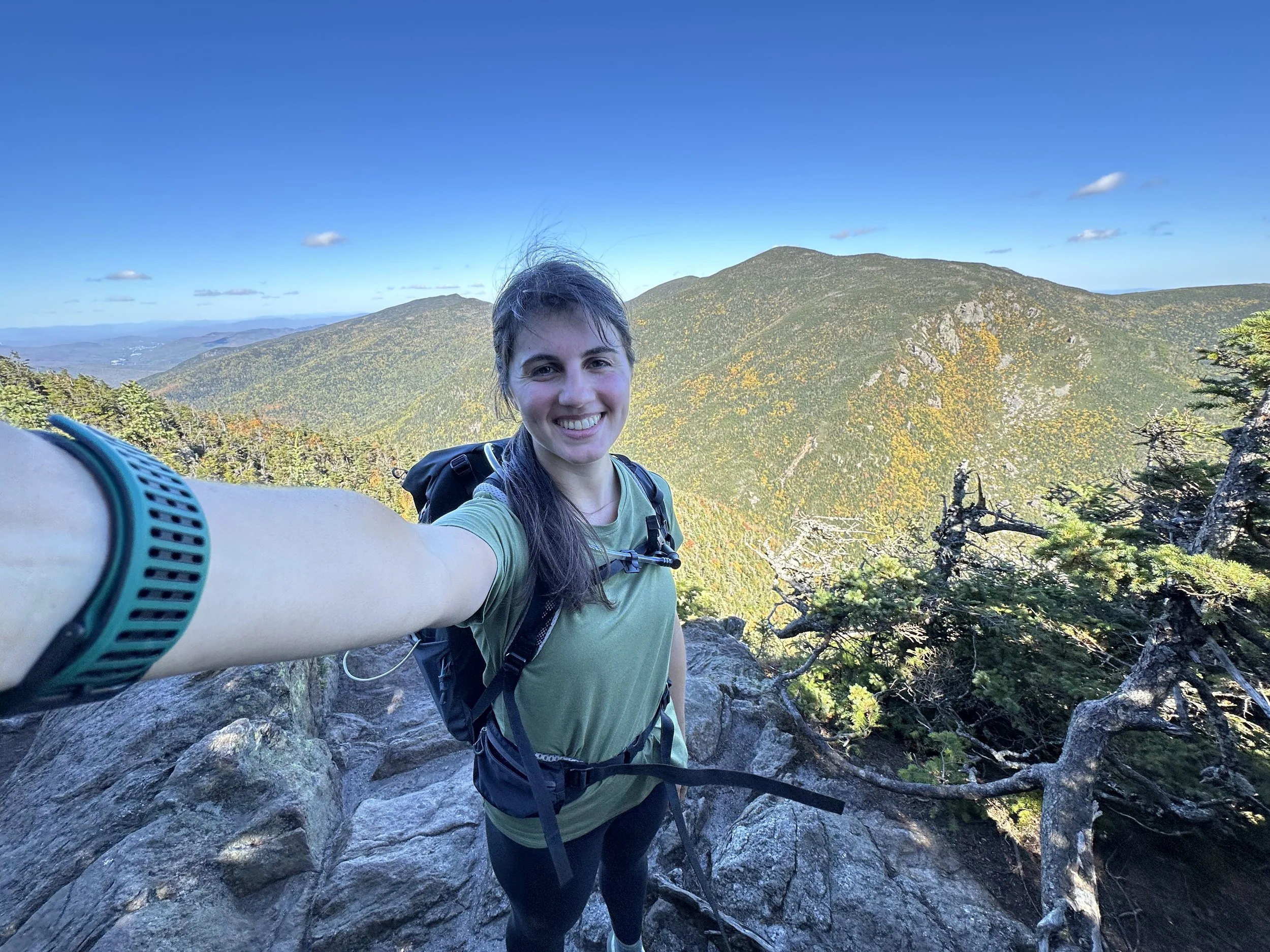
Wildcat Ridge Trail continued to ascend for the final 0.3 miles to the tallest peak on the hike, Wildcat A. Wildcat A had a ledge offering beautiful views looking east towards the surrounding mountains. The ledge was not huge, but we were the only people on it, allowing us to find the perfect snack spot.
Once we finished enjoying the views and a snack, we hiked the Wildcat Ridge Trail back towards the ski area. And before we knew it, we were back at the top of Wildcat Mountain Ski Area!
There was no way we were going to hike down Wildcat Ridge Trail, so we descended on the Polecat Ski Trail. People have descended Wildcat Ridge Trail, but it was much easier to descend the ski trail. We had a car spot, but we could also have road walked to Lost Pond Trail, then taken that back to the parking lot.
Polecat has a lot of loose rock along the trail, making some of the steeper areas tricky, but it was a lot easier than Wildcat Ridge Trail. It was easy to follow since the ski trails have a lot of signage, and we flew down the descent. The ski trails also have stunning views of the mountains!
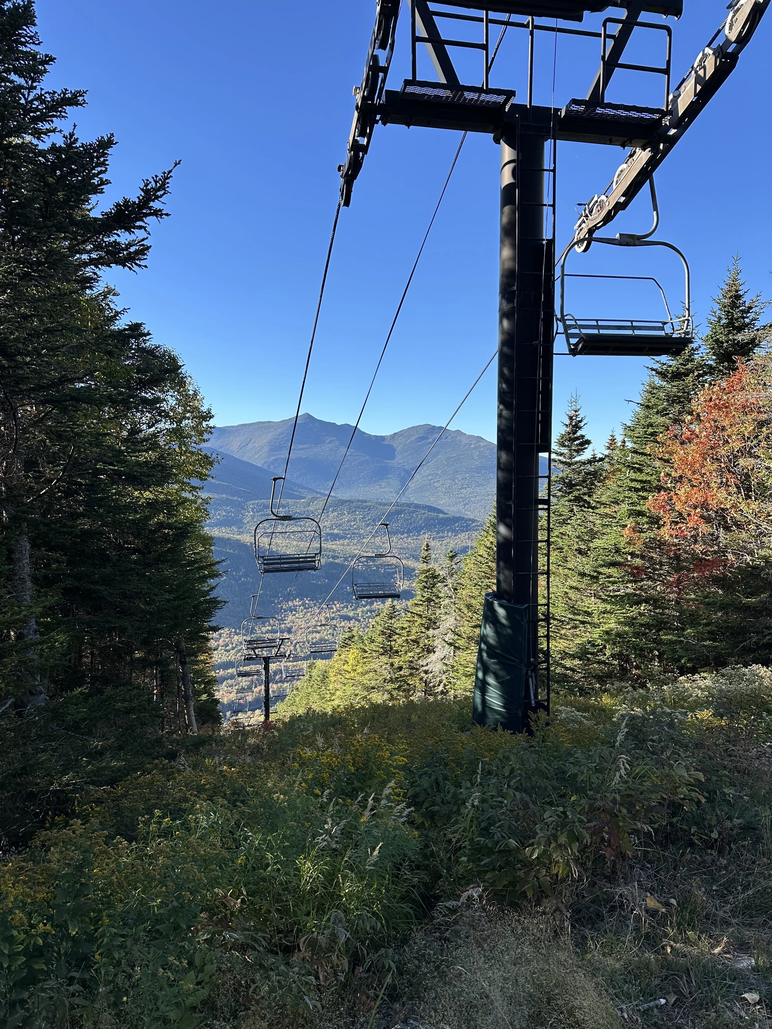
Before we knew it, we were back at the Wildcat Mountain Ski Area parking lot! We had a car spot, so we drove back to the Glen Ellis Scenic Area to grab our other car.
I loved Wildcat Ridge Trail the first time I hiked it and even more the second time! It is definitely a trail I will hike again.
Have you hiked Wildcat Ridge Trail?

Hey, I’m Nichole!
I am the creator behind Nichole the Nomad, the home of my explorations around the world, mountain hikes, and beautiful pictures taken along the way. I have a deep passion for capturing the world in a beautiful light and sharing my experiences.
I created this blog to share my travels, show how beautiful the world is, provide tips and tricks for traveling, and encourage you to explore. Whether you want to travel across the world or explore what’s in your backyard, I hope this blog inspires you to get outside and find your adventure!