Smarts Mountain via Appalachian and Ranger Trail

Disclaimer: This post contains affiliate links. If you click through and make a purchase, my blog may receive a commission at no additional cost to you.
Smarts Mountain NH Hike Overview
Smarts Mountain (3,238’) is in the southern section of the White Mountains on the western side of New Hampshire near the Vermont border. The most popular trail to its summit runs along the Appalachian Trail, where you will likely run into thru-hikers in the summer. Although the summit does not offer views, you can climb a fire tower to get beautiful 360-degree views, landing it on the 52 With a View List.
Trail Details
Trail: Appalachian Trail (also called the Lambert Ridge Trail) > Ranger Trail
Length: 7.7 miles
Elevation Gain: 2,400 feet
My Trail Time: 5 hours hiking; 5.5 hours total
Hike Overview
Smarts Mountain is in the southwest section of the White Mountains near the Vermont border. Although a couple of trails lead to its summit, the most popular route is to ascend the Appalachian Trail and descend the Ranger Trail. The trailhead is small, and parking is not allowed along the road, so I recommend arriving early to secure a spot.
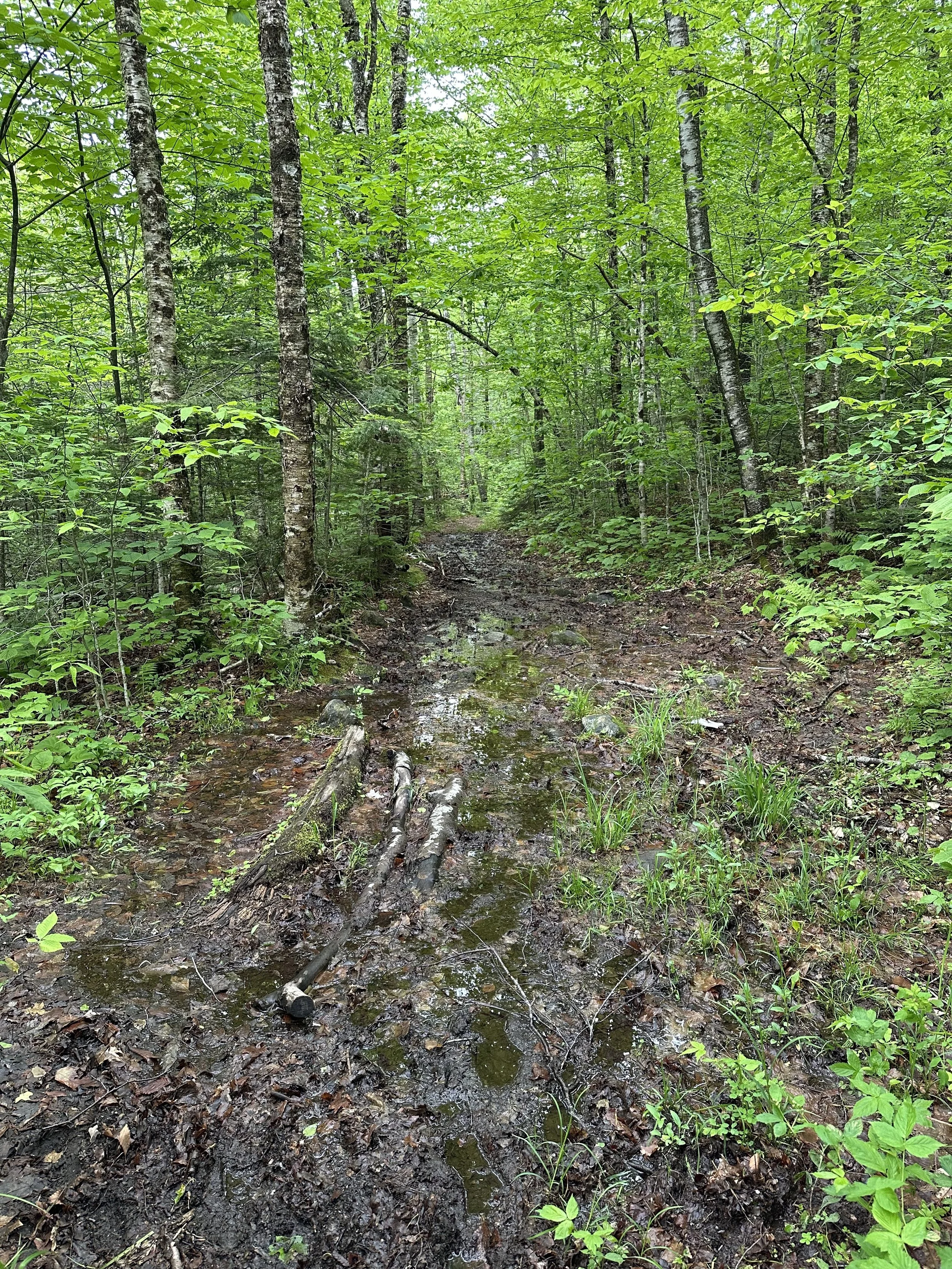
Although the Appalachian Trail and Ranger Trail loop is the most popular way to reach Smarts Mountain, the trail is a bit overgrown in areas. The Appalachian Trail is consistently steep, and just before the summit, it has rock slabs with a wooden staircase and iron rungs. The Ranger Trail is very wet and almost always has running water and mud. Some people avoid Ranger Trail, because of this reason, and hike Smarts Mountain as an out-and-back.
Looking to track your hikes while completing the 52 With a View List?
Whether you're chasing stunning summit views or documenting your adventures, this journal helps you track essential hike details, jot down memories, and reflect on your journey!
Each journal includes:
- individual pages for each mountain
- space to log stats about the hike
- sections to journal about your favorite moments
- completion tracker to celebrate your progress
- and fun extras like Hiking Bingo!

Smarts Mountain via Appalachian and Ranger Trail Guide
June 8, 2025
**Always remember to leave no trace. It is crucial to pack out what you pack in and throw away your trash properly.
Smarts Mountain was my fifth to last mountain on the 52 With a View List, and to be honest, I kept putting it off because it was a long drive from me. But we decided to finally check it off the list on a beautiful Sunday in June.
We arrived at the trailhead around 8:30 AM and grabbed a few of the last spots available. The parking lot was relatively small, and one person parked incorrectly, only leaving room for our cars.
We originally planned to hike Smarts Mountain as an out-and-back via the Appalachian Trail (also called the Lambert Trail) because we heard the Ranger Trail almost always had running water and a lot of mud. We knew it would be a bit longer than hiking the loop, but we thought it would be better to skip the wetter trail.


The steep ascent started immediately on the Appalachian Trail, with the first 1.5 miles steadily climbing up rocks and roots. It rained the day before, so the trail was wet with slippery rocks and roots, which made for a slower ascent.
The morning had some low-hanging clouds, which created a mystical feel to the trail. Everything was lush and bright green which popped even more in the fog. It was stunning!


Just after 1.5 miles, the trail steeply ascended rock slabs before dropping us out onto an open ledge which would normally provide stunning views, but the low clouds covered most of it. The clouds were moving quickly, which was cool to watch from the ledge.


The trail continued back into the woods and quickly began to descend. This area was a bit challenging because of how wet the rocks were, so it was slow going.
Once we were about a mile away from the summit of Smarts Mountain, the trail began to steepen. We slowed our ascent because the slippery rock slabs and roots were difficult to climb.


Soon enough, we passed the Ranger Trail junction, continuing straight towards the summit. This section was the steepest part of the hike but had a few rock stairs, wooden stairs, and iron rungs to help with the ascent.
Once we reached the top of the steep section, the trail flattened out as it traveled towards the summit. Soon enough, we saw the fire tower and were so happy to take a break from the wet trail. We climbed the fire tower to get the 360-degree views before heading to the nearby cabin to enjoy our lunch. The bugs were awful everywhere on the trail but were unbearable near the cabin, so we took a short break before deciding to begin our descent.


We crossed paths with a few hikers as we began our descent who told us that the Ranger Trail was wet but might be better than dealing with the steep and slippery rock slabs on the Appalachian Trail, so we decided to take their advice. Once we reached the Ranger Trail junction, we turned left to begin the descent on what would become one of the wettest trails we had ever hiked.
The Ranger Trail was essentially a river, with running water and lots of mud. The first section had slick rock but was not as steep as the Appalachian Trail, making it a bit easier. But after that, the trail became annoying haha. It converged a few times with a nearby brook, making it very wet with some sections almost ankle-deep. The recent rain did not help either.


We decided to put our heads down and hike as quickly as we could on the Ranger Trail. Towards the bottom, we did get some reprieve with a few dry and flat sections, but they quickly turned back into mud or running water. This section of the trail also crossed the brook a few times, but we easily rock-hopped across all the crossings.


Soon enough, we were at the parking lot and so happy to finally finish this hike. To be honest, this was one of my least favorite trails and mountains on the 52 With a View List. The trail conditions were awful, and I did not love that we had to climb the tall fire tower to see the views. But it is done, and I do not have to hike it again, woohoo!
Have you hiked Smarts Mountain

Hey, I’m Nichole!
I am the creator behind Nichole the Nomad, the home of my explorations around the world, mountain hikes, and beautiful pictures taken along the way. I have a deep passion for capturing the world in a beautiful light and sharing my experiences.
I created this blog to share my travels, show how beautiful the world is, provide tips and tricks for traveling, and encourage you to explore. Whether you want to travel across the world or explore what’s in your backyard, I hope this blog inspires you to get outside and find your adventure!