The Ultimate Guide to Þakgil Iceland
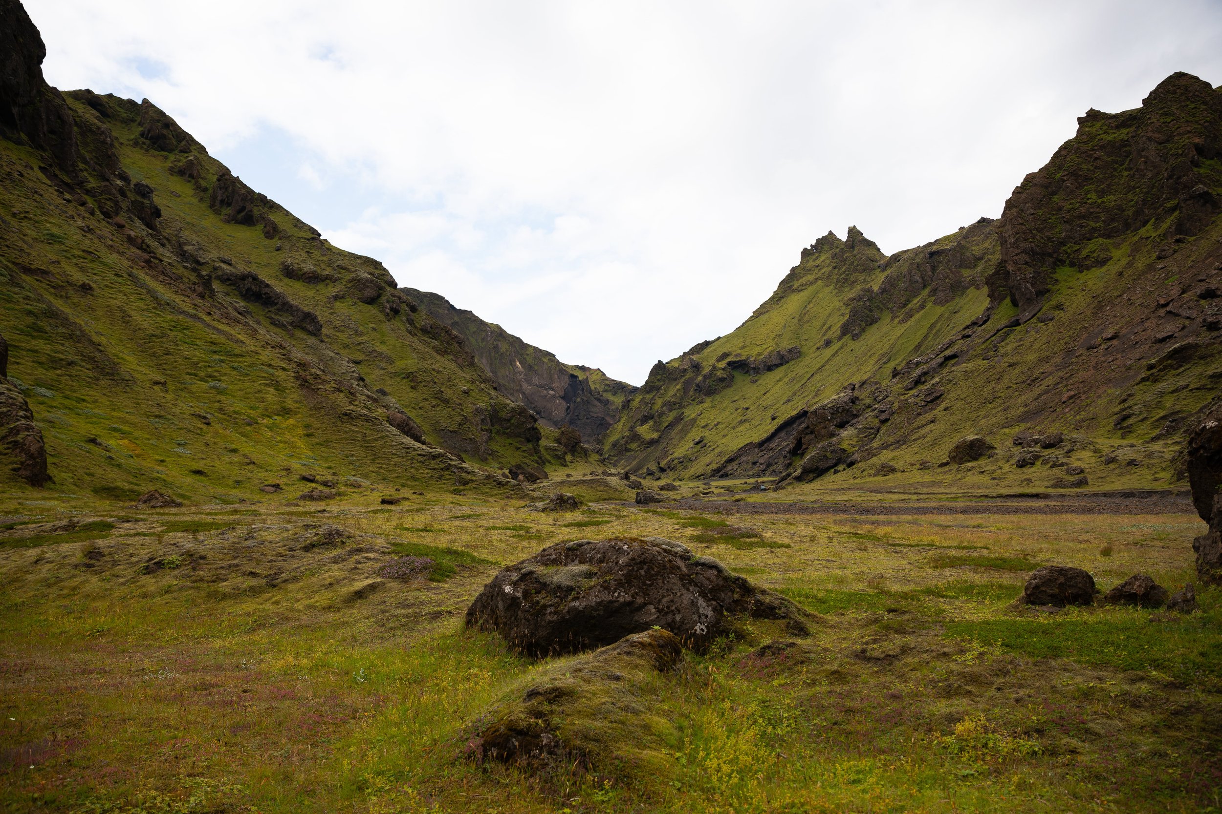
Thakgil is one of the most beautiful areas in Iceland and the perfect place to escape the crowds and enjoy stunning hiking trails. Even though Thakgil sits just east of Vik, it is a hidden gem with fewer crowds than the other nearby attractions. It has everything from canyons to waterfalls to glaciers, and I think it has some of the best views in the area.
To experience everything Thakgil offers, you have to hike. The only downside is the trails in Thakgil are long and strenuous, but if you are an experienced hiker looking for some fun day hikes, Thakgil is the perfect place! The views along the trails in Thakgil are breathtaking, and you will quickly fall in love with the area.
Because Thakgil is a lesser-known area, it does not have many guides for visiting, but that is where this guide comes in! We had a difficult time finding information on visiting Thakgil, so I wanted to create a helpful guide with everything we learned. This guide has everything you need to know to plan an incredible trip to Thakgil, Iceland.
Disclaimer: This post contains affiliate links. If you click through and make a purchase, my blog may receive a commission at no additional cost to you.
How to Get to Þakgil Iceland
There is one way to get into Thakgil, and it is not super easy. To get to Thakgil, you need a 4x4 vehicle approved to drive on F roads.
The drive begins just east of Vik on Kerlingardalsvegur off the Ring Road, which is well-maintained but very rocky. From Vik, the drive takes about an hour because the drive on Kerlingardalsvegur is slow going. The road also has a few sections with steep drop-offs on one side, so it is not for the faint of heart.
But the drive is absolutely gorgeous! The entire drive to Thakgil has stunning views overlooking the surrounding area, including mountains, glaciers, and the ocean. Eventually, the road leads into the Thakgil camping area, where all the trails begin.
Tips for Visiting Þakgil Iceland
Have proper hiking gear and experience. The hiking trails in Thakgil are not easy or short. The trails are long and steep, with long drop-offs along some portions on the ascents and descents. It is crucial to have the proper hiking gear and experience before beginning any hike in Thakgil.
Pack layers and rain gear. The weather in the Thakgil is unpredictable, making it crucial to pack layers and a rain jacket. We were lucky to have beautiful sunny weather for most of the day, but clouds moved in quickly in the afternoon.
Be prepared for the wind. When we visited Thakgil, the wind was pretty crazy when we were hiking. We were happy to have packed layers because the wind makes the temperatures much colder.
Always remember to leave no trace. It’s crucial to pack out what you pack in and leave no trash. Some spots have trash bins, so you can easily throw your trash away. If they don’t have trash bins, you can throw your trash away at a nearby gas station or convenience store.
Where to Stay Near Þakgil Iceland
If you want to stay in Thakgil, you are in luck! Thakgil has campsites and cabins you can rent for your stay. The campsites have gorgeous views in a beautiful field, and the cabins are at the base of the mountains. Each cabin has beds, a small kitchenette, and access to shared bathrooms.
If you do not want to stay in Thakgil, I recommend finding accommodations in Vik! Vik has many places to stay for all budgets and is the perfect place to stay if you want to visit other nearby areas, including black sand beaches and waterfalls. Here are a few great accommodations in Vik:
What to Pack for Þakgil Iceland
The weather in the Iceland highlands can be unpredictable, so it is crucial to pack the right gear and layers for the season you visit.
This is a great baseline for what to pack, and you can adjust as needed:
The Best Hikes in Þakgil Iceland
Thakgil has four main hiking trails: the red trail, the yellow trail, the purple trail, and the Ravine Walk. The campground has a trail map with short descriptions, so you can figure out which is best for you. Each trail is absolutely gorgeous and will make you work the views, but each one is worth the effort.
The Ravine Walk
Distance: 0.5 miles
Difficulty: Easy
The Ravine Walk is the shortest and easiest trail in Thakgil, making it a great warm-up to the other hikes. The trail travels away from the campground into a beautiful moss-covered canyon. Although it does not have anything exciting, the views along the canyon floor are pretty.
Remundargil Ravine Loop (Purple Trail)
Distance: 7.8 miles
Difficulty: Difficult
The Remundargil Ravine Loop is the second shortest trail in Thakgil, even though it is almost eight miles long. But this was our favorite hike in Thakgil because the views were spectacular! The 7.8-mile loop is not easy or for the faint of heart. It has many steep ascents and descents with steep drop-offs that had our adrenaline racing.
The trail begins a short walk down the road from the campground, and Thakgil has plenty of trail markers, making it easy to see where you need to go. The first section of the Remundargil Ravine Loop includes an incredibly steep ascent to the top of the canyon. The trail looks like a sheep's path because it is thin and has steep drop-offs along portions of it. This section had our hearts racing from the drop-offs and the difficult ascent.
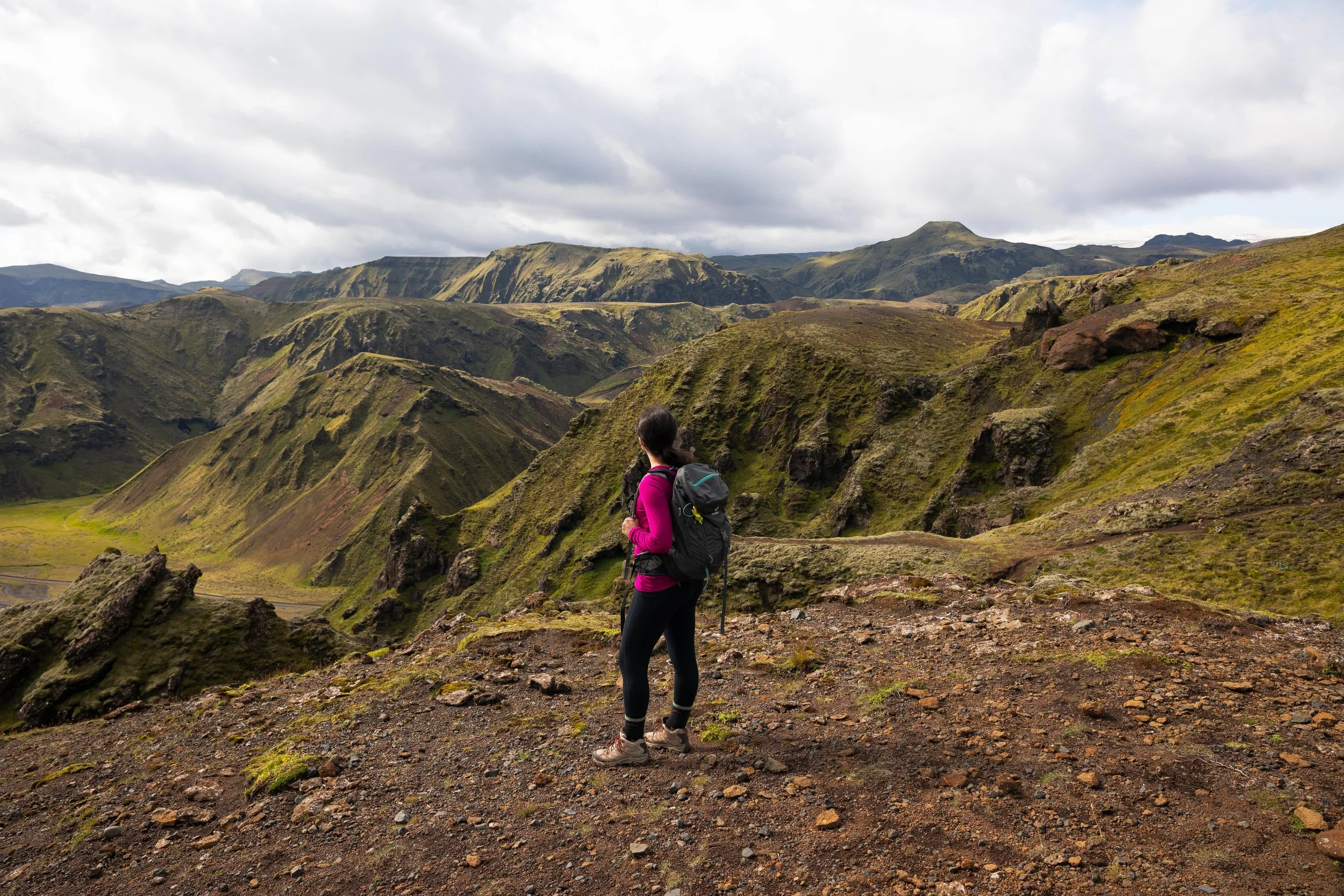
Once at the top of the canyon, you get breathtaking views overlooking Thakgil. These were some of my favorite views along the hike! The trail continues along the top of the canyon, providing beautiful 360-degree views before it begins to steeply descend to the canyon floor. The descent onto the canyon floor was pretty sketchy. It took us longer than anticipated to hike down because the trail had loose rock and dirt, making it difficult to descend.
The trail continues left once at the canyon floor towards a beautiful and hidden waterfall. The walk along the canyon floor was incredible, too! It made us feel small in the best way as we walked through the tall moss-covered canyon. The trail leads deeper into the canyon to a beautiful waterfall, Remundargilsfossi. It was amazing to see a waterfall and have no one around!
The trail follows back the way you came along the canyon floor and continues left around the base of a mountain towards the spur trail leading to the glacier viewpoint. The final mile to the glacier viewpoint is the last steep ascent, but the effort is worth it! Once at the top, you have a stunning view of Kötlujökull!
Although you could follow the trail the way you came and go back up to the canyon rim, I do not recommend it. Instead, you can follow the trail markers along a dirt road to Kerlingardalsvegur. The walk along Kerlingardalsvegur seems long, but it is much easier than hiking the steep sections to the canyon rim.
Austurafréttur Range Loop (Yellow Trail)
Distance: 10.5 miles
Difficulty: Difficult
The Austurafréttur Range Loop is known for being one of the most beautiful hikes in Thakgil, but it is not easy. The 10.5-mile trail makes you work for the views.
You can start this hike a few ways. If you want to avoid walking on the road on your way back, you can cut a few miles off the trail by ascending via the purple trail to the top of the canyon before turning left onto the yellow trail and continuing on the loop counterclockwise. As mentioned above, this section of the trail is very steep and has long drop-offs until you reach the top of the canyon. But once at the top, the 360-degree views are spectacular!
Thakgil has many trail markers, so once at the top, you can turn left to travel away from the purple trail and continue on the path with the yellow markers. The Austurafréttur Range Loop begins to climb with a few steep sections until it reaches a beautiful viewpoint of Kötlujökull. This section of the trail is stunning and makes the effort worthwhile!
After the glacier viewpoint, the trail travels on what looks like a dirt road for ATVs for the rest of the hike. Along the descent, you can also hike a side trail to a viewpoint of Huldujökull if you want to add another beautiful glacier overlook to the adventure! If not, you can continue making the long descent back to the parking lot.
You could also continue onto the red trail and hike back to the campground with more beautiful views. The red trail has steep, exposed sections with three river crossings.
Mælifell Loop (Red Trail)
Distance: 8.7 miles
Difficulty: Difficult
The Mælifell Loop is the most strenuous hike in Thakgil even though it is not the longest. This trail includes steep and exposed sections and a few river crossings. But the views are stunning and make the effort worthwhile! We did not hike this trail but talked to a few hikers who loved it and shared their experiences.
You can hike the Mælifell Loop in either direction, but we heard from other hikers that it is better to follow it clockwise and ascend the steep, exposed sections first. If you hike it clockwise, you also hike through the three river crossings at the beginning.
Although the trail is very steep, the views are spectacular! Eventually, the red trail connects with the yellow trail, where you can choose to continue left to the viewpoint of Huldujökull or begin the descent down a dirt road that looks like it is for ATVs. You could also continue hiking clockwise on the yellow trail if you are up for a long, strenuous day hike.
If you want to visit Thakgil in Iceland, this guide is the perfect place to start planning your trip. It has everything you need to know about visiting Thakgil, Iceland!
Hey, I’m Nichole!
I am the creator behind Nichole the Nomad, the home of my explorations around the world, mountain hikes, and beautiful pictures taken along the way. I have a deep passion for capturing the world in a beautiful light and sharing my experiences.
I created this blog to share my travels, show how beautiful the world is, provide tips and tricks for traveling, and encourage you to explore. Whether you want to travel across the world or explore what’s in your backyard, I hope this blog inspires you to get outside and find your adventure!
Pin it for later!


