9 Beautiful Hikes in Waterville Valley, New Hampshire
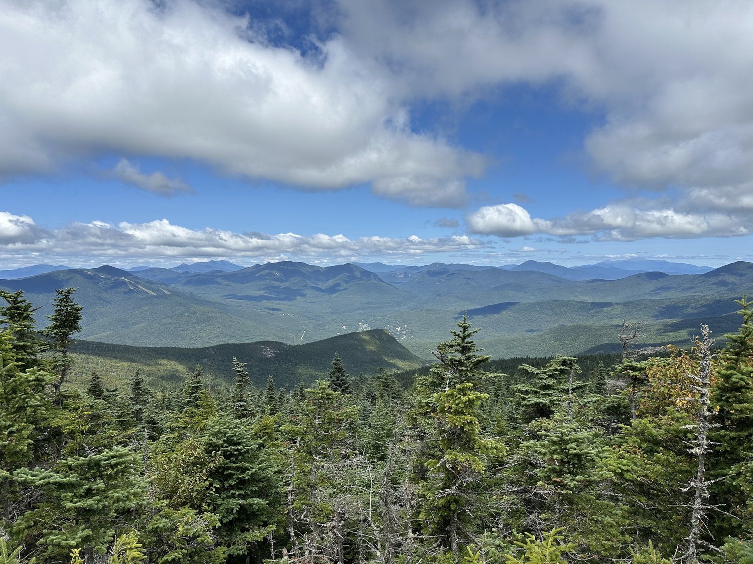
Waterville Valley is a beautiful mountain town in the western section of the White Mountains in New Hampshire. It is known for the Waterville Valley Ski Resort, but the area offers many other things to do year-round!
Hiking is one of the best ways to explore everything Waterville Valley offers, and there are trails for all levels. Whether you want to hike to a 4,000 footer or beautiful pond, Waterville Valley has hikes for you! This guide has everything you need to know about the best hikes in Waterville Valley!
Disclaimer: This post contains affiliate links. If you click through and make a purchase, my blog may receive a commission at no additional cost to you.
Tips for Hiking in Waterville Valley
Hiking in Waterville Valley, New Hampshire, is one of the best ways to experience its beauty. Here are some tips and things to consider when you hike in Waterville Valley:
The trails in Waterville Valley are rugged. They have roots and rocks, so it is important to wear supportive shoes with traction. Even the easy hikes have obstacles. If you want more information on the trail and its current conditions, you should read recent trail reviews.
The weather in Waterville Valley can change quickly. The White Mountains weather can be unpredictable, and Waterville Valley is no different. It could be a sunny and warm day in the morning and change into a windy and rainy day within a few hours. It is essential to check the weather before starting the hike.
Many trailhead parking lots fill up quickly, especially in the summer and fall. I recommend arriving at the most popular trails early in the morning to secure a parking spot. Some parking lots will fill up before 8:00 AM.
Some roads are closed in the winter. If you want to winter hike, make sure to research if the road the trailhead is on is closed. For example, most of Tripoli Road is closed in the winter.
Always remember to leave no trace. It’s crucial to pack out what you pack in and leave no trash. Some spots have trash bins, so you can easily throw your trash away. If they don’t have trash bins, you can throw your trash away at a nearby gas station or convenience store.
What to Pack for Hiking
New Hampshire mountain weather can be unpredictable, so it is crucial to pack the right gear and layers for the season you visit. Make sure to pack the proper hiking gear for the trail you are hiking.
This is a great baseline for what to pack, and you can adjust as needed:
- hiking boots
- moisture-wicking clothes
- hiking backpack
- food and water
- rain jacket
- fleece jacket
- sunscreen
- Ten Essentials
The Best Hikes in Waterville Valley
Mount Tecumseh
Difficulty: Moderate
Length: 5 miles
Elevation Gain: 2,300 feet
Mount Tecumseh sits next to Waterville Valley Resort and is one of the smallest 4,000 footers in New Hampshire. It is also known to be one of the easiest 4,000 footers, so this is a popular hike in Waterville Valley. The 5-mile roundtrip trail begins in the Waterville Valley Resort parking lot and follows the Mount Tecumseh Trail to the summit.
Although Mount Tecumseh is one of the easiest 4,000 footers in New Hampshire, the trail gains 2,300 feet of elevation in 2.5 miles. But the views are worth the effort! The summit of Mount Tecumseh has a small viewpoint, but if you want the best views, you can continue about 0.6 miles to the top of the ski resort.
The views from here are breathtaking and worth the extra effort! No matter which way you decide to hike Mount Tecumseh, you will quickly realize why it is one of the best hikes in Waterville Valley.
Jennings Peak
Difficulty: Moderate
Length: 6.1 miles
Elevation Gain: 2,100 feet
Jennings Peak may be shorter than the surrounding mountains, but it does not lack beautiful views! I recommend hiking the 6.1-mile loop counterclockwise to ascend the steepest sections and enjoy a gradual descent.
There are a few stream crossings along the trail, but they are usually passable. Noon Peak is the first summit on the hike and offers stunning views overlooking the White Mountains. Jennings Peak is shortly after and offers more beautiful views for your efforts.
Note: You can also add Sandwich Mountain to the hike to make it 8.4 miles roundtrip.
Sandwich Mountain
Difficulty: Difficult
Length: 7 miles
Elevation Gain: 2,600 feet
Sandwich Mountain is another beautiful hike in Waterville Valley and offers views overlooking the surrounding area. The 7-mile roundtrip trail follows the same route to Jennings peak, allowing you to enjoy gorgeous views along the hike to Sandwich Mountain.
The trail gains over 2,600 feet of elevation, so it is steep in some sections, but the views from Noon Peak and Jennings Peak make it worth it! And Sandwich Mountain has gorgeous views with endless mountain layers. You will not be disappointed with this fun hike in Waterville Valley!
Welch-Dickey Loop
Difficulty: Moderate
Length: 4.4 miles
Elevation Gain: 1,800 feet
The Welch-Dickey Loop is one of the most popular hikes in Waterville Valley for good reasons! The trail has some of the best views in the area! Although it is a popular trail, it is not as easy as it may seem. The 4.4-mile roundtrip trail gains 1,800 feet of elevation over many exposed rock slabs, which can be difficult to hike when wet. But I promise the effort is worth it for the views!
I recommend hiking the Welch-Dickey Loop counterclockwise to ascend Welch Mountain first. Both mountains offer stunning views, so you will not be disappointed with this beautiful hike in Waterville Valley!
East Pond and Little East Pond
Difficulty: Easy/Moderate
Length: 4.7 miles
Elevation Gain: 1,000 feet
The hike to East Pond and Little East Pond is an underrated hike in Waterville Valley. The 4.7-mile loop is well-maintained and travels through a beautiful forest before arriving at Little East Pond. I recommend hiking it clockwise to save East Pond for last since it has the best views on the trail! If you decide to hike to East Pond and Little East Pond, you will not be disappointed!
Mount Osceola
Difficulty: Moderate
Length: 5.6 miles
Elevation Gain: 2,000 feet
Mount Osceola is another 4,000 footer in Waterville Valley and offers stunning views overlooking the White Mountains. Similarly to Mount Tecumseh, Mount Osceola is considered one of the easiest 4,000 footers, so the trail is crowded.
The 5.6-mile roundtrip trail travels through a beautiful forest, with a few switchbacks near the summit to help with the elevation gain. The 2,000 feet of elevation gain is consistent with minimal breaks, but there are only a few steep sections and rock scrambles.
Once you reach the summit, you can enjoy stunning views! If you hike Mount Osceola, you will quickly realize why it is one of the best hikes in Waterville Valley!
Mount Osceola and East Osceola
Difficulty: Difficult
Length: 8.3
Elevation Gain: 2,900 feet
If you reach Mount Osceola and want to hike further, you are in luck! You can add its neighbor East Osceola, which is another 4,000 footer. Adding East Osceola to the hike will make it 8.3 miles roundtrip. Between Mount Osceola and East Osceola is a rock scramble known as the ladder. The ladder is a vertical rock scramble and a fun addition to the hike if you are up for it! You can also avoid the ladder by hiking a side trail near the scramble.
The summit of East Osceola is in the treeline, but it has a few spur trails that lead to viewpoints. Mount Osceola and East Osceola is a fun hike in Waterville Valley if you want an adrenaline-pumping rock scramble and beautiful views!
Tripyramids
Difficulty: Difficult
Length: 11.6 miles
Elevation Gain: 2,900 feet
The Tripyramids are a set of three summits in Waterville Valley, and two are on the 4,000-footer list. The 11.6-mile roundtrip trail is a fun hike if you enjoy hiking up exposed rocks. The exposed slides are fun but can be dangerous if they are wet.
The beginning of the trail follows an old logging road which is a nice warm-up for what comes next. Most of the elevation is on the slides leading to the summits, so they are steep. I recommend hiking the trail clockwise because the North Slide is much easier to ascend than descend.
Although this is a strenuous hike, the views, especially on the slides, make it worth it! If you are up for a difficult hike in Waterville Valley, the Tripyramids are for you!
The Scaur
Difficulty: Easy/Moderate
Length: 4.8 miles
Elevation Gain: 600 feet
Although The Scaur is not the tallest mountain in Waterville Valley, it offers beautiful views of the surrounding mountains! The 3.8-mile roundtrip trail travels through a beautiful wide trail before ascending steeply to the summit. Although this trail does not gain as much elevation as others on this list, it gains most of it in the last section, so the trail is steep! Once you reach The Scaur, you get gorgeous views overlooking Waterville Valley!
If you visit Waterville Valley, I recommend adding these hikes to your itinerary! This guide has everything you need to know about the best hikes in Waterville Valley!
Hey, I’m Nichole!
I am the creator behind Nichole the Nomad, the home of my explorations around the world, mountain hikes, and beautiful pictures taken along the way. I have a deep passion for capturing the world in a beautiful light and sharing my experiences.
I created this blog to share my travels, show how beautiful the world is, provide tips and tricks for traveling, and encourage you to explore. Whether you want to travel across the world or explore what’s in your backyard, I hope this blog inspires you to get outside and find your adventure!
More New Hampshire Travel Inspiration
The Best Hikes Near Plymouth NH
Pin it for later!


