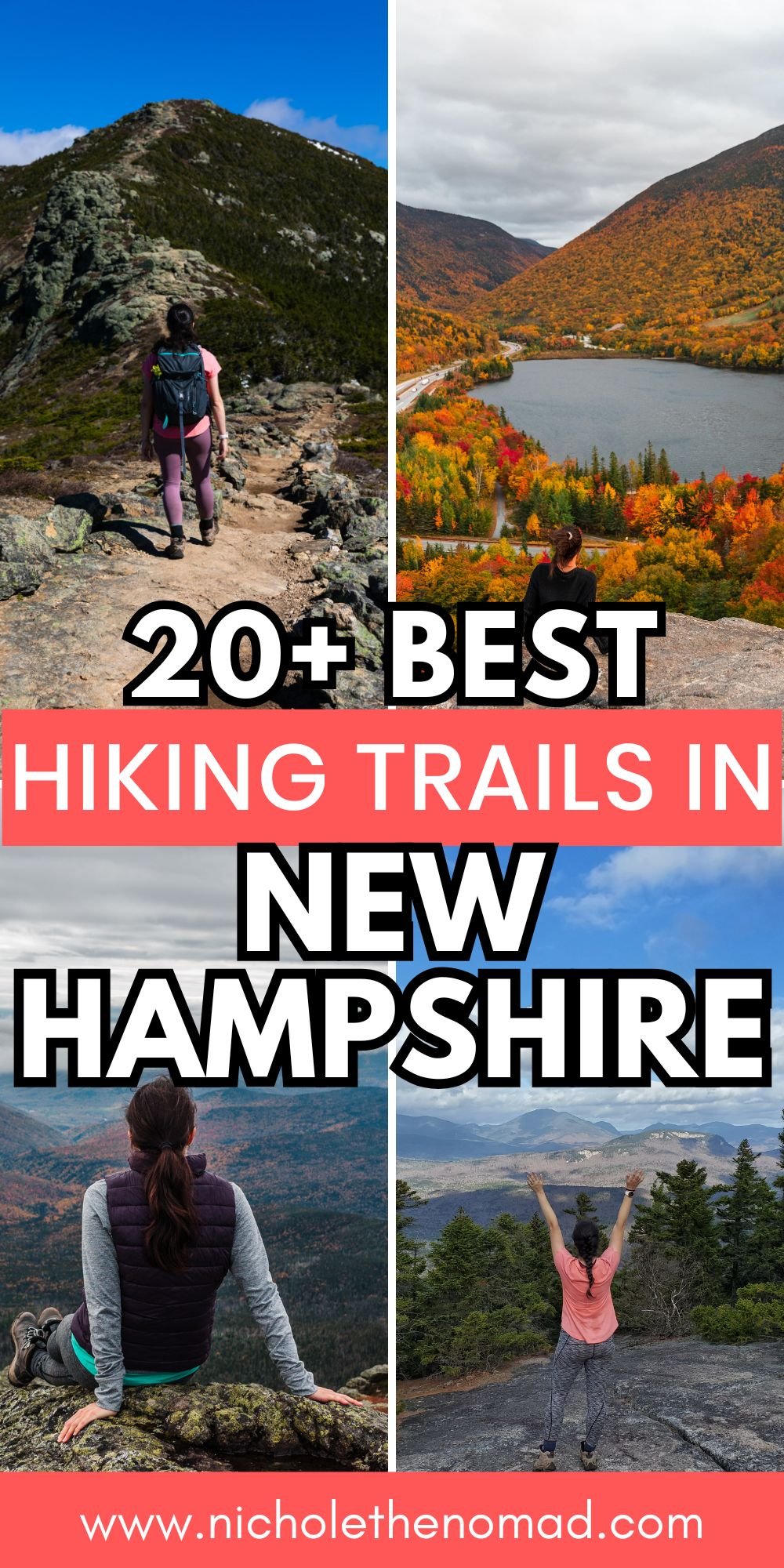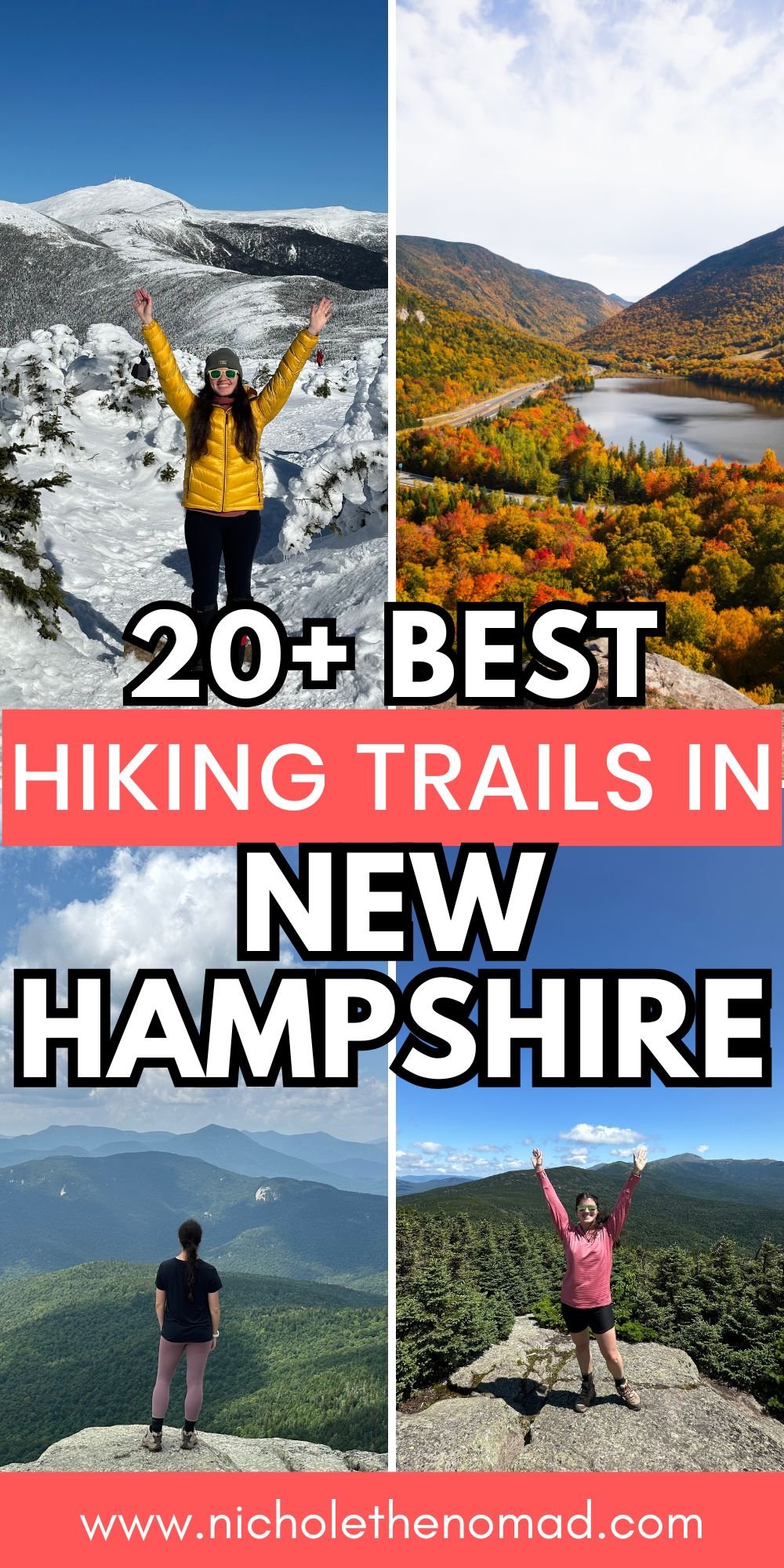
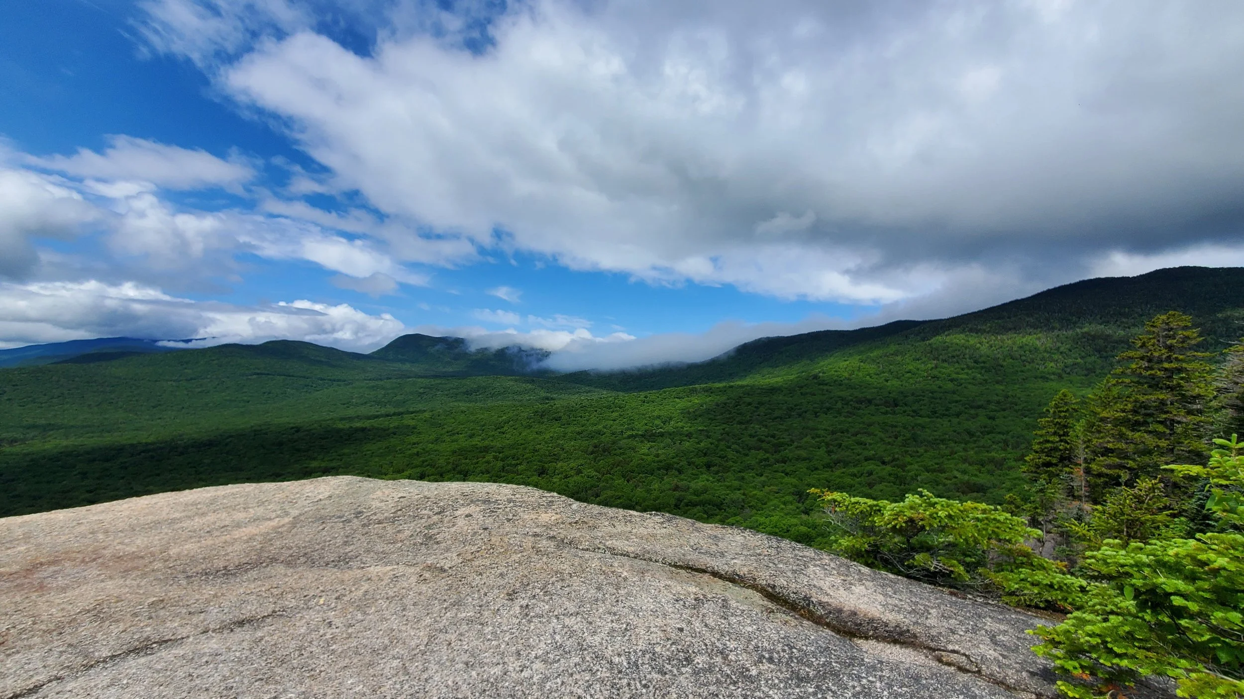
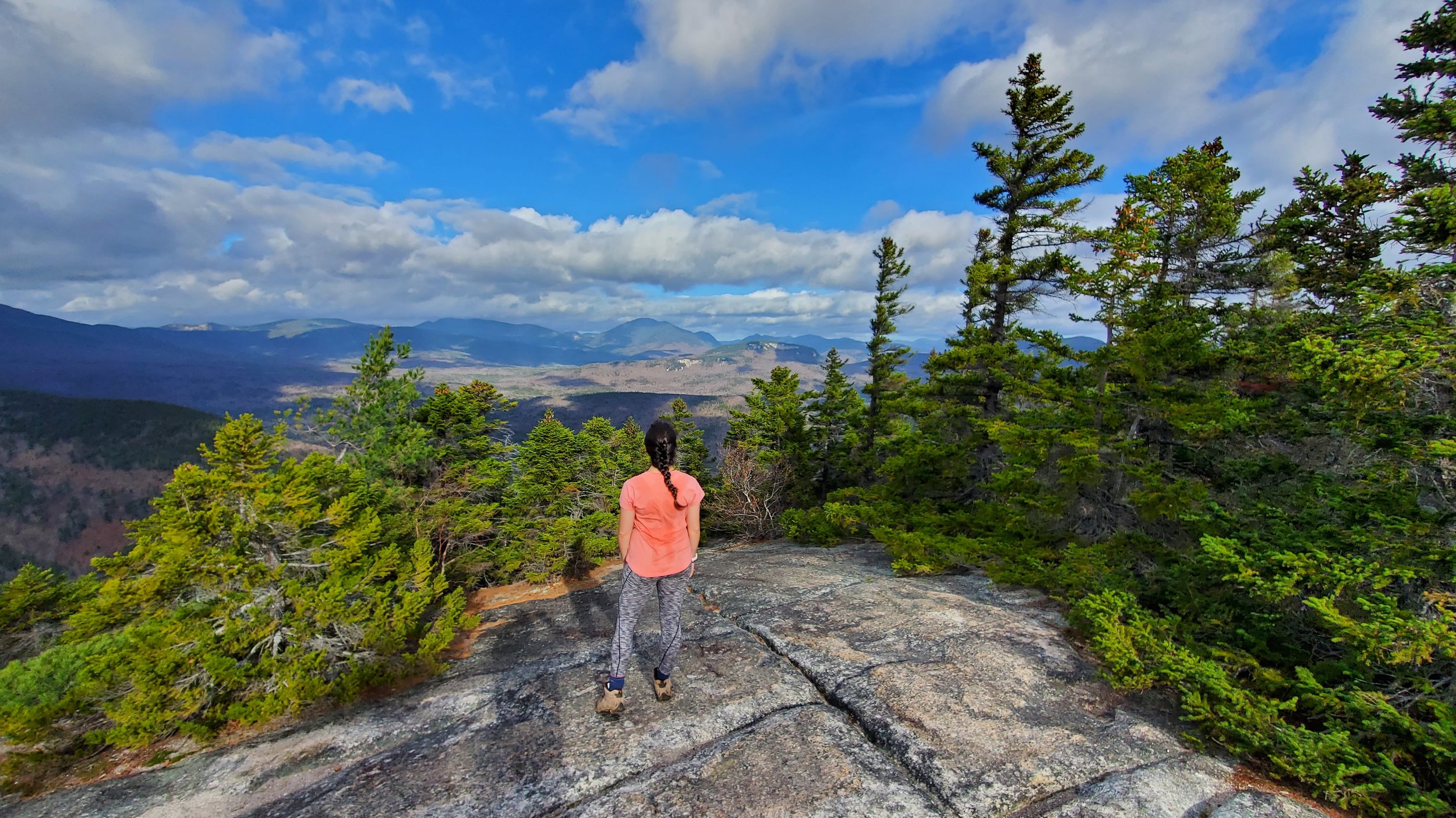
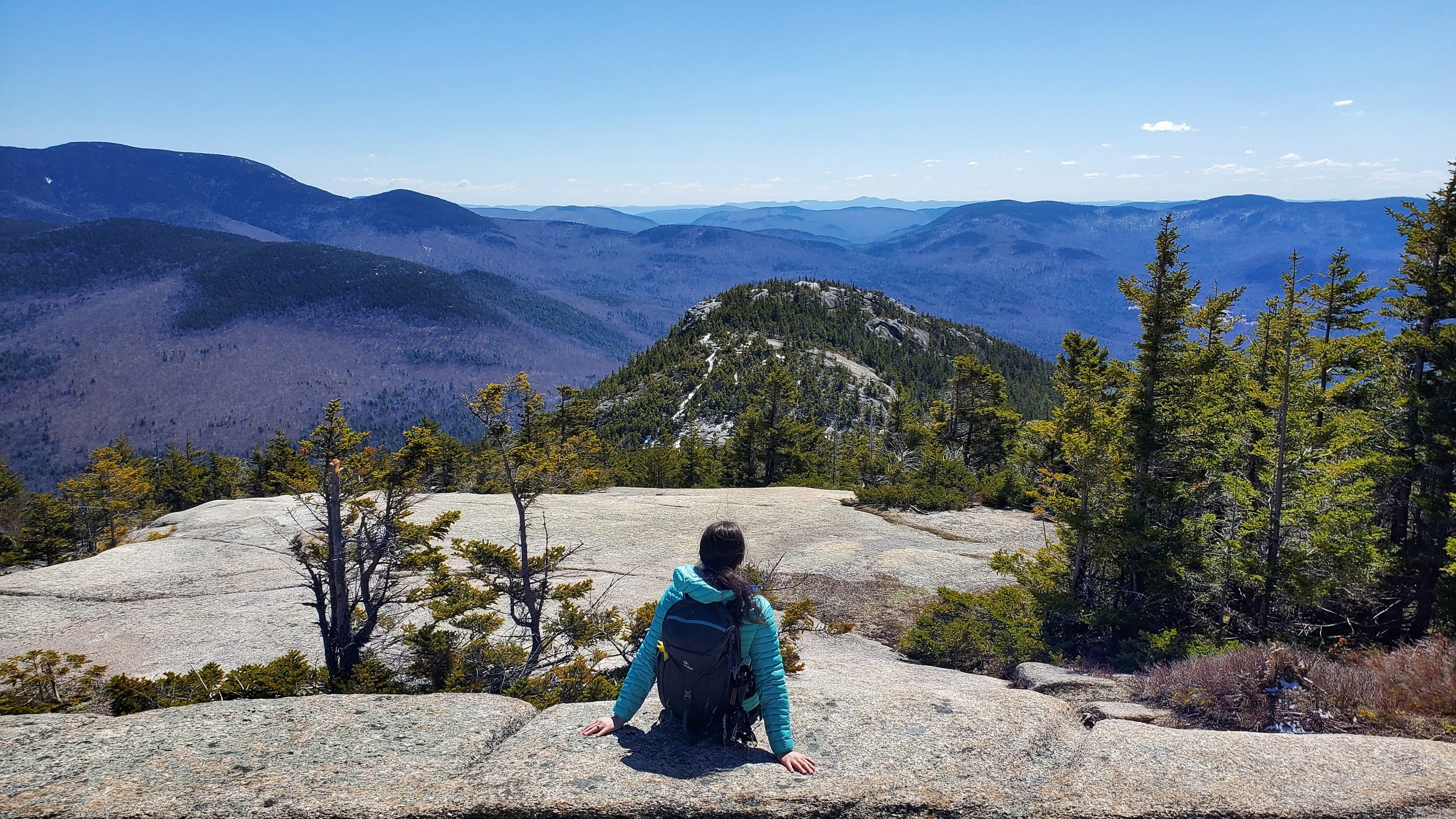
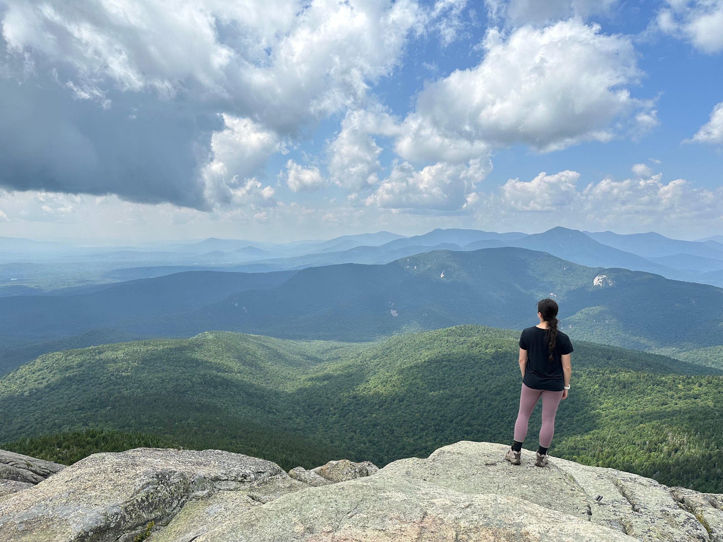
20+ Best Hikes in the White Mountains, New Hampshire (By a Local!)
One of the most beautiful places to hike in New Hampshire is the White Mountains. It has the tallest mountains in the state, stunning waterfalls, and breathtaking views no matter where you hike.
I have been hiking in the White Mountains for years, and the views never disappoint. The White Mountains are home to some of my favorite hikes in New England, so I know you will love hiking here!
And the best part? It has trails for all levels! Whether you want an easy hike to a waterfall or a strenuous climb to the tallest mountain in New Hampshire, the White Mountains have a hike for everyone to enjoy.
I have hiked almost every mountain in the White Mountains, and I can provide you with some of the best! I know it may seem like I am mentioning a lot of trails in this guide, but there are many others not on this list, too. And trust me, they are all beautiful!
This guide has everything you need to know about the best hikes in the White Mountains, including easy, moderate, and strenuous trails. Get your hiking boots ready for some fun adventures!
Disclaimer: This post contains affiliate links. If you click through and make a purchase, my blog may receive a commission at no additional cost to you.
Tips for Hiking in the White Mountains
The trails in the White Mountains are rugged and steep. Do not underestimate the trails in the White Mountains! Even easy hikes have rocks and roots, so make sure you do proper research to ensure you have the correct gear. I also recommend reading recent trail reviews to get current information on the trail conditions.
The weather in the mountains can change quickly. The weather in the mountains can be unpredictable, and the summit weather can be drastically different than the weather at the trailhead. It is essential to check the weather before starting the hike, using resources like the Mount Washington Observatory or NOAA.
Consider hiring a guide! If you are not ready to head out on your own just yet, consider hiring a guide! They can provide amazing trail recommendations and help ensure you have a safe trip, while also supporting a local business.
The trailhead parking lots can fill up quickly, especially in the summer and fall. I recommend arriving at the most popular trails as early as you can to secure a parking spot and having a backup plan in case it is full.
Always remember to leave no trace. It’s crucial to pack out what you pack in and leave no trash. Some of these spots have trash bins, so you can easily throw your trash away. If they don’t have trash bins, you can throw your trash away at a nearby gas station or convenience store.
What to Pack for Hiking in the White Mountains
New Hampshire mountain weather can be unpredictable, so it is crucial to pack the right gear and layers for the season you visit. Also, every hike is different, but having these pieces of hiking gear is a good starting point. I also have a day hiking packing list to help you figure out what to pack.
This is a great baseline for what to pack, and you can adjust as needed:
- hiking boots
- moisture-wicking clothes
- hiking backpack
- food and water
- rain jacket
- fleece jacket
- insulated jacket
- sunscreen
- Ten Essentials
Best Hikes in the White Mountains, New Hampshire
Note: Everyone’s difficulty ratings are different, so please always do your own research before heading out. Even though some trails may be defined as easy or moderate, they may be more difficult for someone else.
Easy Hiking Trails
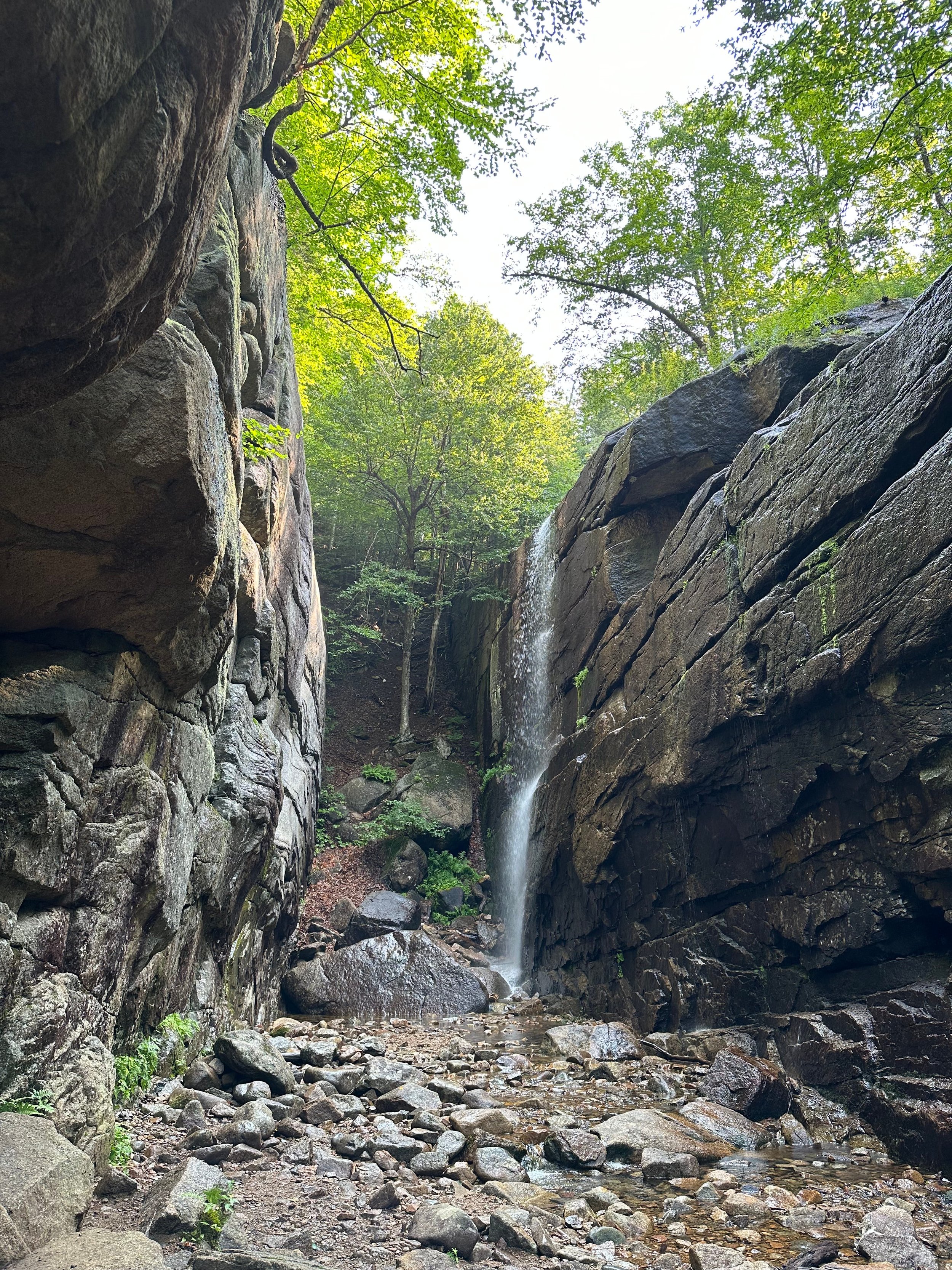
Sabbaday Falls
Length: 0.7 miles round trip
Elevation Gain: 100 feet
Things to Know: You need to pay for parking at the trailhead. You can also use the America the Beautiful Pass.
Sabbaday Falls is one of my favorite easy hikes in the White Mountains! This stunning waterfall is on the Kancamagus Highway with multiple cascades ending in an emerald-colored basin pool.
And the best part about Sabbaday Falls is that it only requires a 0.6-mile round-trip hike, most of which is flat. There is a boardwalk that brings you to various viewpoints of the waterfall, all of which are stunning.
I have two favorite viewpoints of Sabbaday Falls. The first is towards the beginning of the boardwalk, where you see the falls cascading into the emerald-colored pool. And yes, the color is stunning! My second favorite is at the top of the boardwalk overlooking the top of the falls.
The Flume Gorge Trail
Length: 2.2 miles round trip
Elevation Gain: 460 feet
Things to Know: Make a reservation in advance to enter.
The Flume Gorge is easily one of the most unique easy hikes in the White Mountains. It is a beautiful gorge located at the base of Mount Liberty in Franconia Notch State Park, and it is one of the most popular trails in the area.
The 2-mile trail wanders through the 800-foot natural gorge, offering beautiful views of waterfalls, including Avalanche Falls and Liberty Cascade. Although the trail has a few uphill sections with stairs, it is perfect for all levels of hikers.
I recommend hiking the loop counterclockwise, so you walk through the gorge to Avalanche Falls first. Avalanche Falls is my favorite waterfall along the hike! As you continue to the second half of the loop, you will get beautiful views of the surrounding mountains and another waterfall, Liberty Cascade. The entire trail is stunning, so I know you will fall in love with it quickly!
Echo Lake Loop
Length: 1 mile round trip
Elevation Gain: 20 feet
Things to Know: Echo Lake State Park requires a fee to enter.
Echo Lake Trail is one of my favorite year-round easy hikes in the White Mountains. I have hiked it in every season, and the views of Cathedral Ledge never disappoint!
The 1-mile round-trip loop brings you around Echo Lake and along the base of Cathedral Ledge. The trail is flat with minimal elevation gain, making it perfect for the entire family to enjoy!
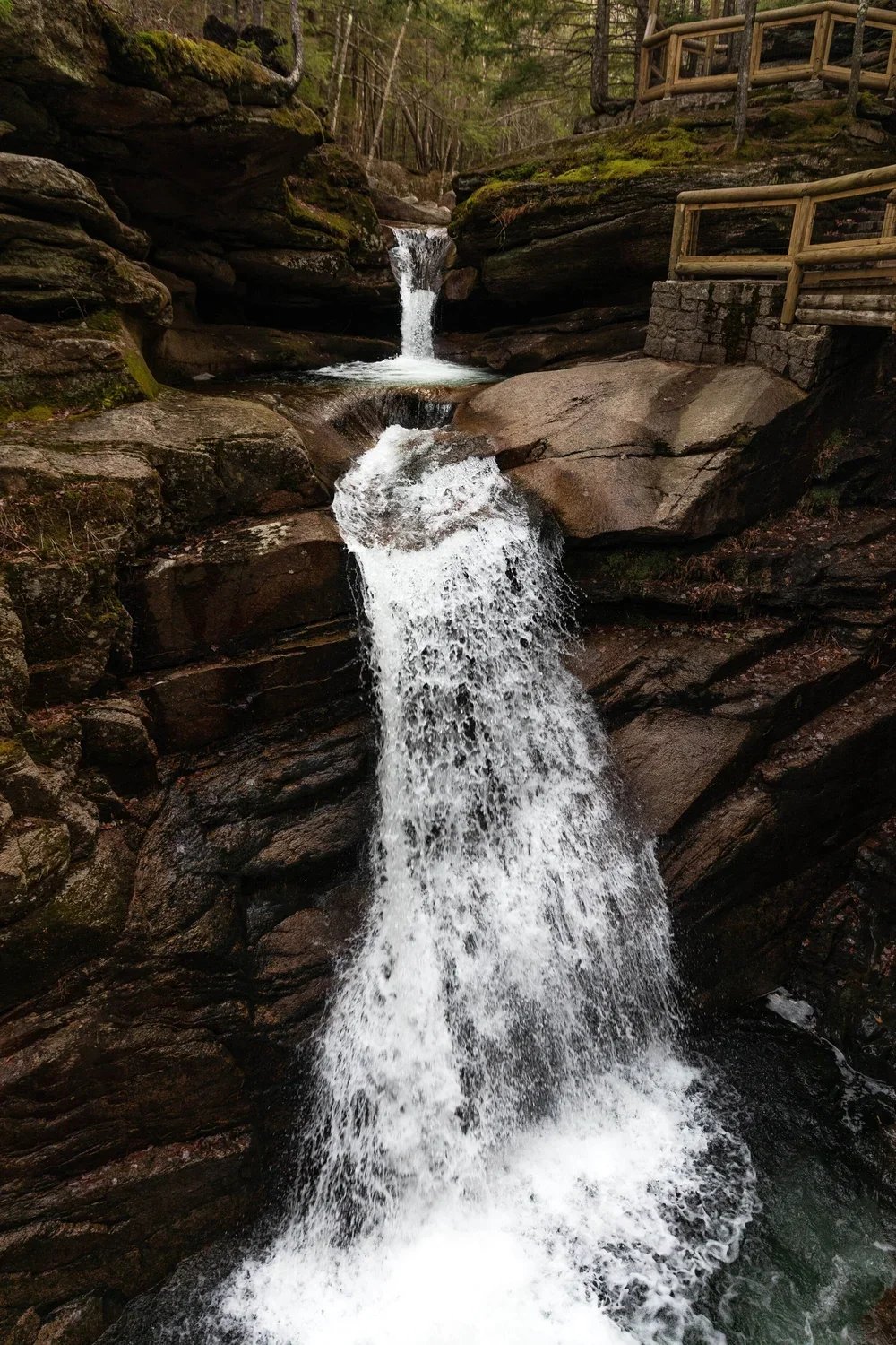
Ripley Falls
Length: 1.1 miles round trip
Elevation Gain: 300 feet
Things to Know: Although this is an easier hike, it steadily gains elevation until the waterfall.
Ripley Falls is a beautiful 100-foot waterfall in Crawford Notch, and it is one of my favorite waterfalls in New Hampshire!
The hike to Ripley Falls is an easy 1.1-mile round-trip to the waterfall viewpoint. The trail gradually but steadily climbs to the viewpoint of Ripley Falls, and although it is not steep, it makes you work for the views! But the effort is worth it because Ripley Falls is stunning.
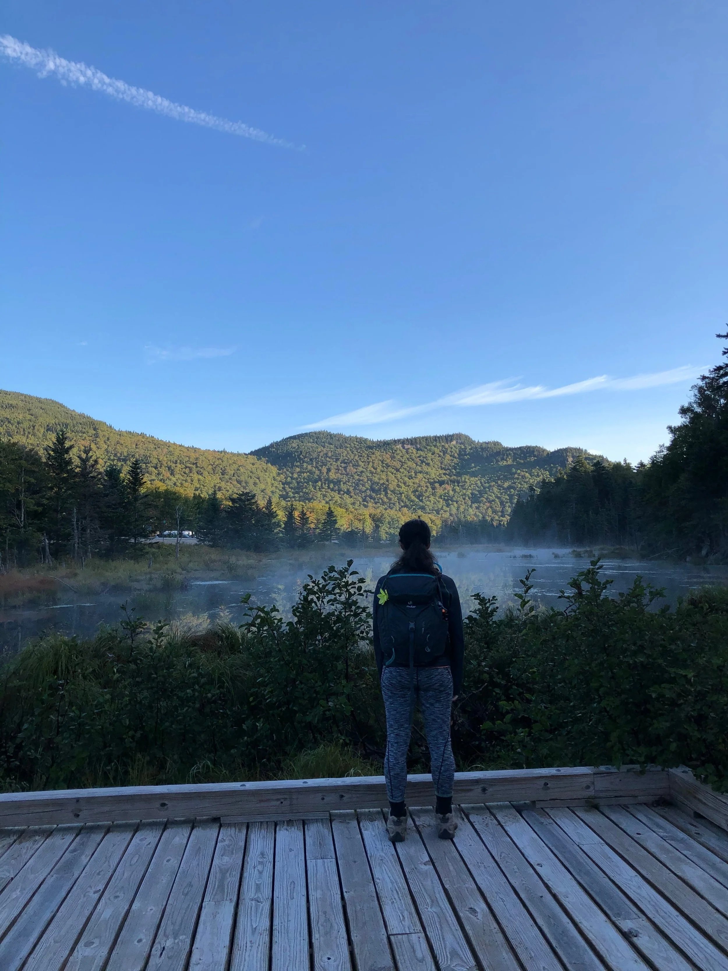
Lost Pond Trail
Length: 1.7 miles round trip
Elevation Gain: 300 feet
Things to Know: Parking is at Joe Dodge Lodge, across the street from the trailhead.
Lost Pond Trail is a hidden gem in the White Mountains and a great, easy hike if you do not want to hike to the top of a mountain but still want beautiful views.
The trail begins across from Joe Dodge Lodge and immediately brings you to a short boardwalk near a small body of water. The views of the surrounding mountains from the boardwalk are stunning! The trail then goes into the forest before traveling along the shores of Lost Pond.
I actually found Lost Pond Trail accidentally! I was hiking a long trail to a few nearby 4,000-footers, but the trail I originally planned to hike was under construction, and Lost Pond Trail was the detour route. It was a fun, easy hike, and the views at the beginning are stunning.
Moderate Hiking Trails
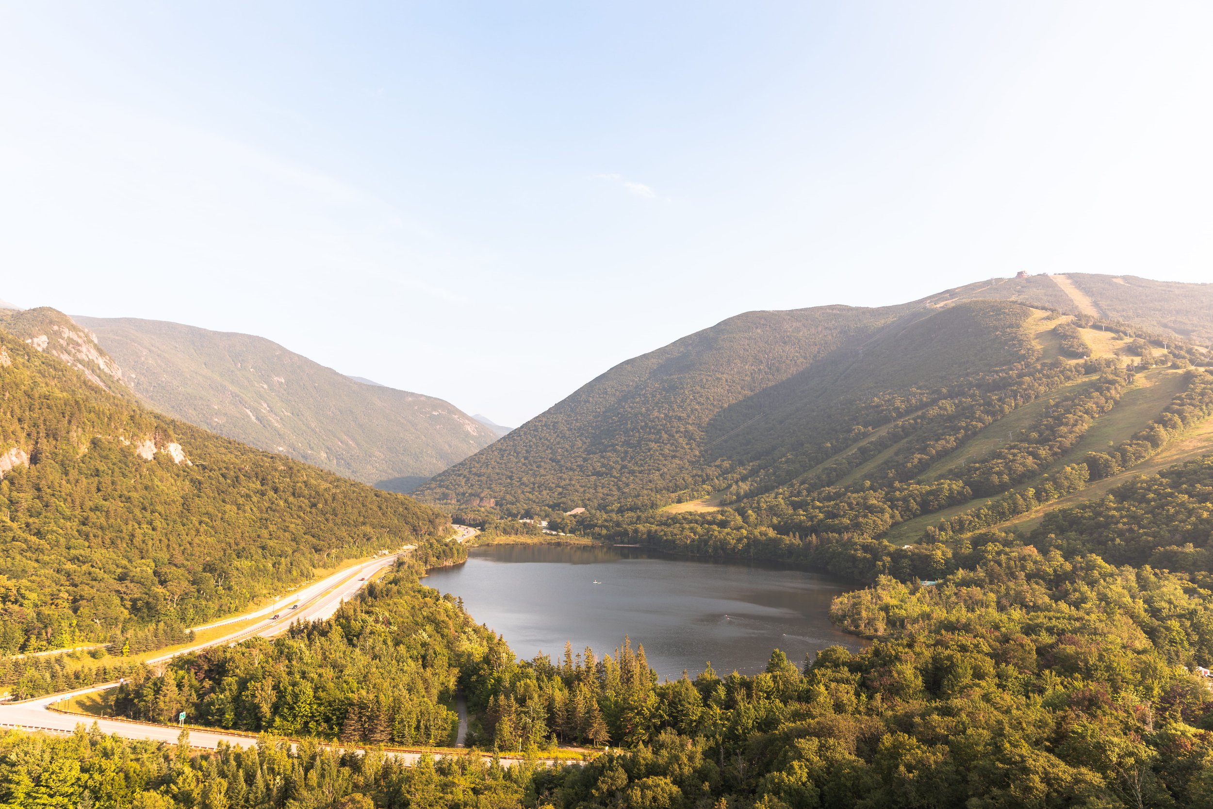
Artist Bluff and Bald Mountain
Length: 1.4 miles round trip
Elevation Gain: 430 feet
Things to Know: This is one of the most popular hikes, especially in the fall. I recommend arriving at the parking lot early in the morning to enjoy a quieter trail.
Artist Bluff is arguably one of the most popular spots in the White Mountains, especially in the fall. It offers breathtaking views looking south over Franconia Notch, and, honestly, it is one of my favorite hikes year-round.
The trail starts relatively flat as it travels around towards the base of Artist Bluff. It then becomes steep, gaining 200 feet in 0.2 miles, but before you know it, you arrive at Artist Bluff and get gorgeous mountain views.
The second half of the loop continues to ascend before arriving at Bald Mountain. Many people skip Bald Mountain, but it offers a different perspective overlooking Franconia Notch and Cannon Mountain. Honestly, the views are stunning, so do not skip it!
As I mentioned, this is one of the most popular trails in the White Mountains, and I recommend arriving in the morning to enjoy a quieter hike. If you plan to hike this in the fall, you should arrive as early as you can because the midday crowds are intense!
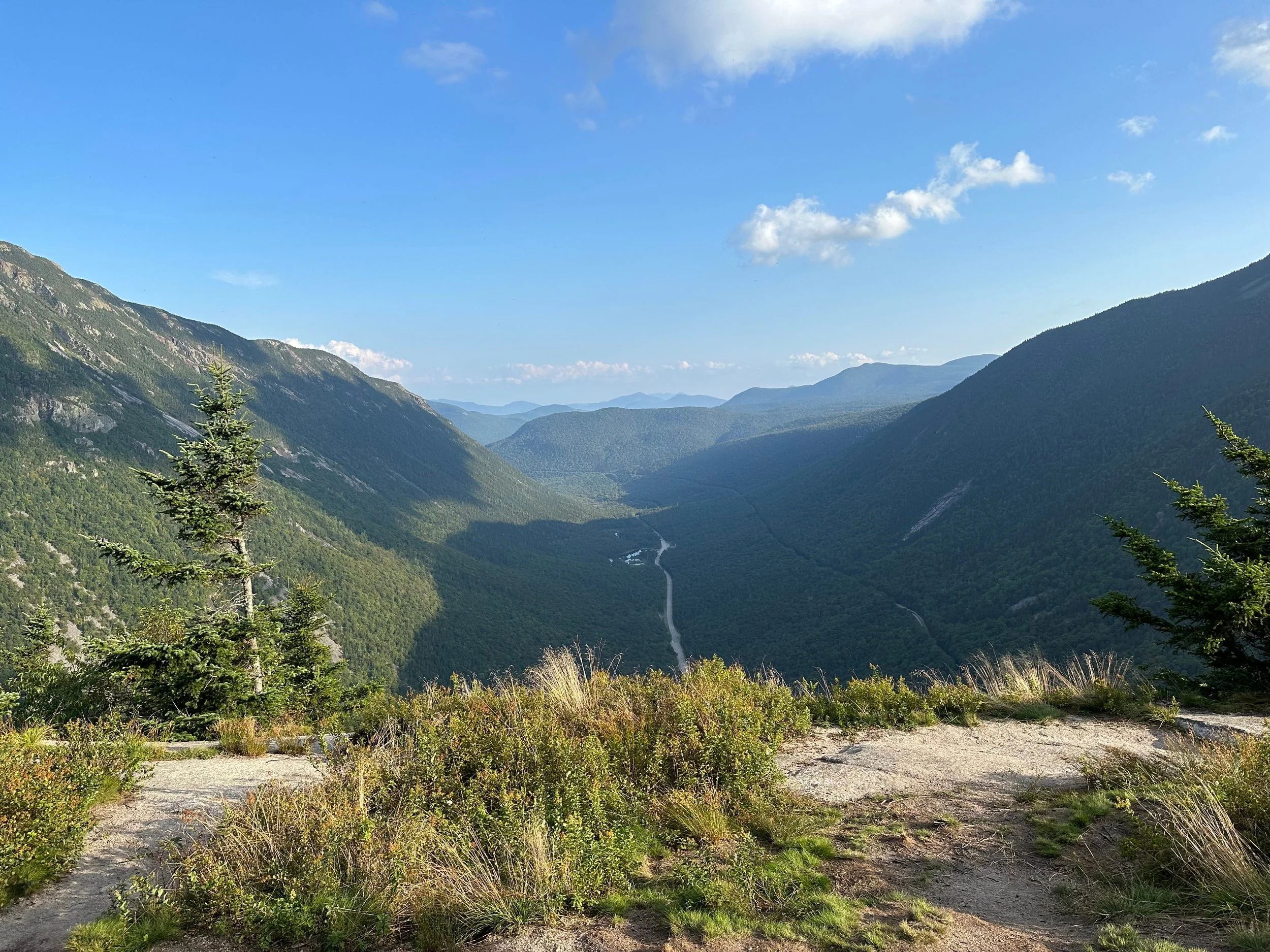
Mount Willard
Length: 3.1 miles round trip
Elevation Gain: 900 feet
Things to Know: Mount Willard is another incredibly popular hike, and I recommend arriving in the morning to enjoy a quieter hike.
Mount Willard has stunning views overlooking Crawford Notch, making it another one of the most popular hikes in the White Mountains. I have hiked this trail in every season, and let me tell you, it never disappoints!
The trail begins behind Crawford Notch Depot and steadily climbs to Mount Willard. The elevation is consistent all the way to the top, but trust me, once you see the views, you will see the effort was worth it!
The most popular time to hike Mount Willard is in the fall when the foliage takes over the valley, but as I mentioned previously, it is a fantastic year-round hike.
Boulder Loop
Length: 3.4 miles round trip
Elevation Gain: 920 feet
Things to Know: You need to pay for parking at the trailhead. You can also use the America the Beautiful Pass.
Boulder Loop is a fun hike in the White Mountains along the Kancamagus Highway, offering stunning views from the ledges. This is another trail I have hiked year-round, and honestly, I love it in every season!
You can hike the loop in any direction, but I like hiking it counterclockwise to ascend the steep section and descend the more gradual side of the loop. I prefer hiking up steep sections, but it is a personal preference!
The trail also begins at the Albany Covered Bridge, so make sure to stop and take a photo here! It is a beautiful spot along the river, and I love relaxing here after I finish hiking.
Mount Pemigewasset
Length: 3.7 miles round trip
Elevation Gain: 1,250 feet
Things to Know: Parking for Mount Pemigewasset is in the same lot as the Flume Gorge.
Mount Pemigewasset is one of my favorite hikes in Franconia Notch! The views overlooking the surrounding mountains are gorgeous, and it will quickly become one of your favorite hikes in the White Mountains.
The trail begins in the same parking lot as the Flume Gorge and wanders under the highway before steadily ascending to the summit. The elevation gain is consistent all the way to the top, but trust me, the effort is worth it! The summit may not have 360-degree views, but they are breathtaking.
Mount Pemigewasset is another popular fall hike, but I love hiking it in every season. Summer is my favorite, although the bugs in the early summer can be a pain!
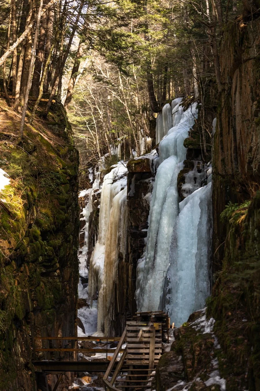
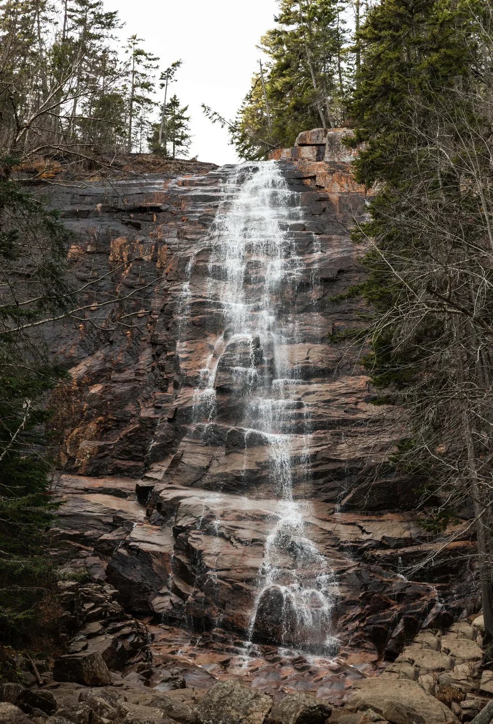
Arethusa Falls
Length: 3 miles round trip
Elevation Gain: 890 feet
Things to Know: Arethusa Falls is a popular trail, especially in the summer and fall, and the parking lot can fill up by 9 AM. I recommend arriving in the morning to enjoy a quieter trail.
Arethusa Falls is the tallest waterfall in New Hampshire, and one of the most popular waterfall hikes year-round. Although summer and fall are the most popular seasons to visit, I loved hiking to Arethusa Falls in winter. Once Arethusa Falls freezes, the waterfall is stunning!
The hike is 3 miles round trip and steadily climbs to the waterfall, but the effort is worth it! Once you reach the highest point on the trail, it will begin descending to the stream that leads to Arethusa Falls.
If you are looking for a longer hike, you can add Frankenstein Cliff to the hike. It is a strenuous hike, but the views from Frankenstein Cliff are beautiful.
North and Middle Sugarloaf
Length: 3.5 miles round trip
Elevation Gain: 1,060 feet
Things to Know: The parking lot is small and fills up quickly, especially in the fall. I have arrived at 9 AM at an almost full parking lot, so the earlier you can start, the better.
North and Middle Sugarloaf have some of my favorite views in the White Mountains! I love this hike so much that I have hiked it in every season because I just cannot get enough. The views never disappoint!
The first part of the trail is relatively flat as it follows along the river before it steadily climbs towards North and Middle Sugarloaf. Although you do not have to hike to both summits, I recommend it because they offer different views. I recommend heading to North Sugarloaf first and saving Middle Sugarloaf for last because, in my opinion, it has the best views.
Hedgehog Mountain
Length: 4.5 miles round trip
Elevation Gain: 1,400 feet
Things to Know: You can hike the loop in either direction, but I prefer hiking it counterclockwise to ascend the steepest section of the trail.
Hedgehog Mountain is one of my favorite hikes on the Kancamagus Highway because the views are stunning. I have hiked this trail in every season, and truly, the views never disappoint. It is a fun hike year-round!
The UNH Trail offers beautiful views along the ledges, overlooking Mount Passaconaway and the Sandwich Wilderness. The trail makes you work for the views with a few steep sections and consistent elevation gain, but it is worth it!
I recommend taking your time and enjoying each ledge and viewpoint along the hike. The ledges make perfect snack spots to take a break and enjoy the views before continuing the hike. One summer, I stayed on the ledges for almost an hour because it was so peaceful!
Mount Potash
Length: 4.1 miles round trip
Elevation Gain: 1,400 feet
Things to Know: The first river crossing along the trail can be difficult when the water is high. It has plenty of rocks to hop across, but when the river is high, those are either fully submerged or slippery.
Potash Mountain is next to Hedgehog Mountain, but it offers different views looking towards Mount Passaconaway, the Tripyramids, and the northern section of the White Mountains. I love that two mountains next to each other can offer such different views (both of which are beautiful!).
Do not let the short mileage fool you, though! The trail is a steady climb to the summit without many breaks. But the effort is worth it once you see the views at the summit!
The trail also has a river crossing at the beginning that can be difficult to cross when the water is high. I lucked out and hiked Mount Potash when the river was low, but I have heard from friends that it can be difficult to cross. Luckily, the river crossing is at the very beginning of the trail, so if it is too high, you can turn around and hike Hedgehog Mountain!
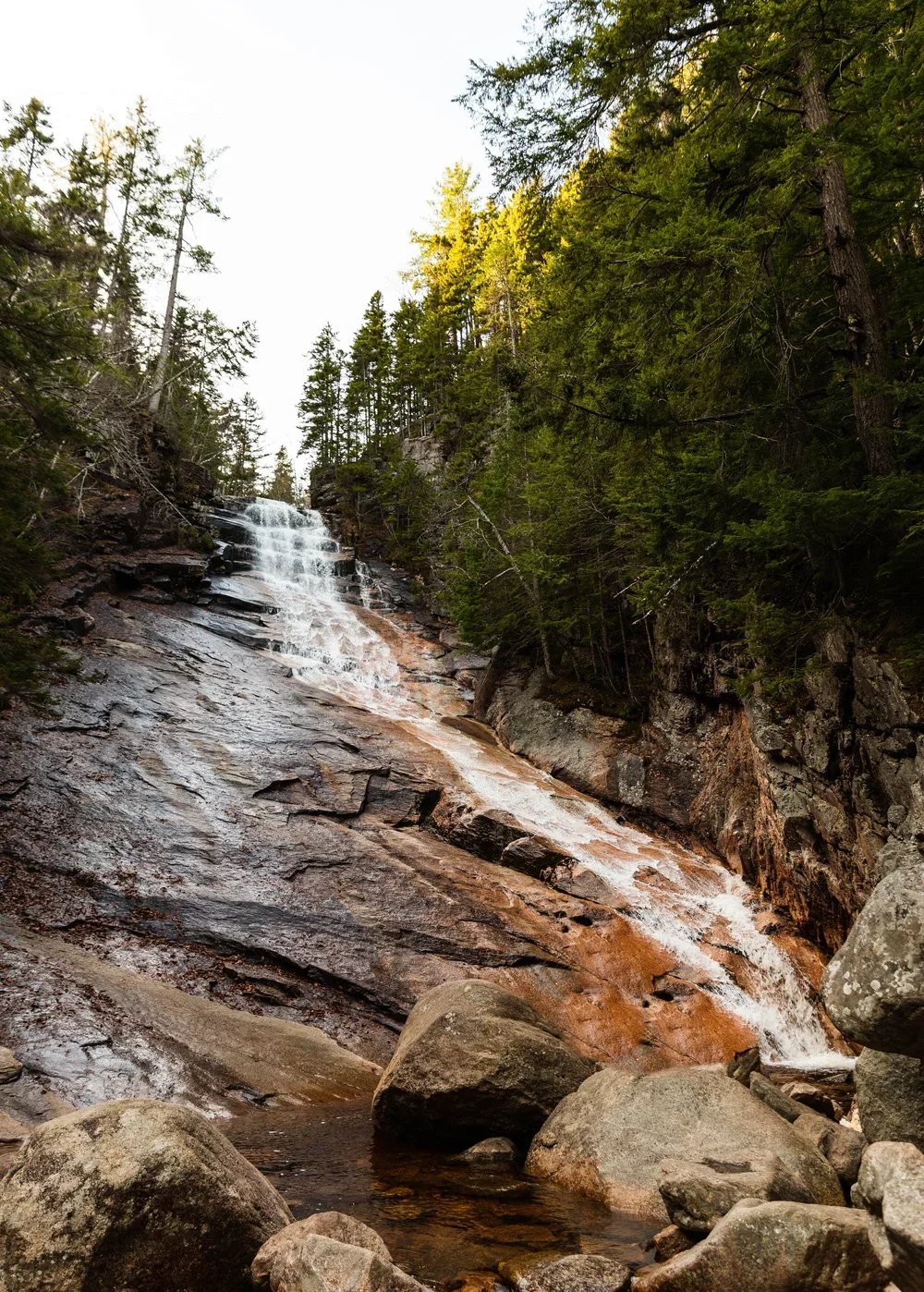
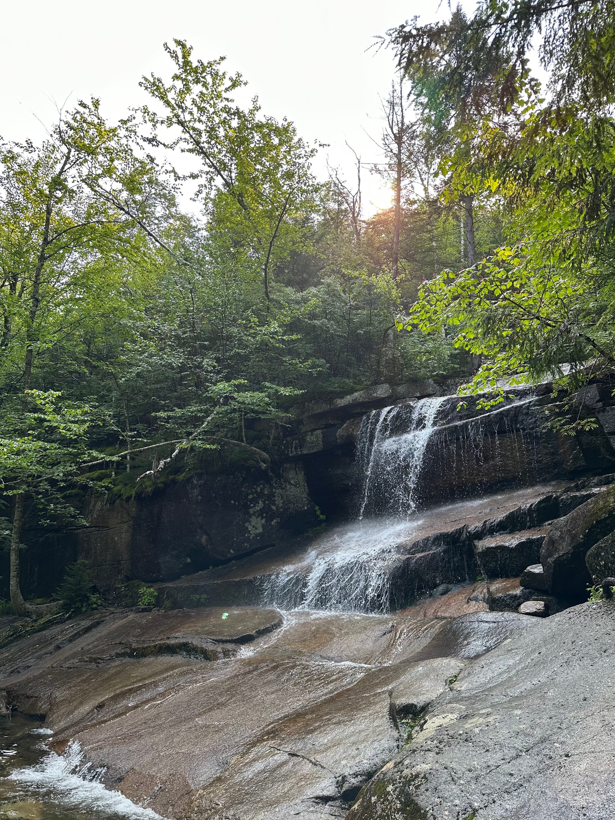
Champney Falls
Length: 3.3 miles round trip
Elevation Gain: 700 feet
Things to Know: You need to pay for parking at the trailhead. You can also use the America the Beautiful Pass.
Champney Falls is a stunning waterfall on the popular trail leading to Mount Chocorua. But if you do not want to hike all the way to the summit, you can enjoy a shorter hike to the waterfall.
Champney Falls is one of my favorite waterfall hikes in the White Mountains because you get two stunning waterfalls along the hike. The 3.1-mile round-trip trail brings you to Champney Falls and Pitcher Falls.
Champney Falls is the first waterfall you see, but I recommend continuing past it to Pitcher Falls. Pitcher Falls is gorgeous as it cascades down a rock face. I promise, it will become one of your favorite waterfalls in New Hampshire!
Because Champney Falls is along one of the most popular trails in the White Mountains, I recommend arriving at the trailhead early. On weekends, the parking lot is full before 9 AM.
Lonesome Lake
Length: 3.1 miles round trip
Elevation Gain: 1,000 feet
Things to Know: The trailhead parking is across the highway from Mount Lafayette’s parking lot, so this lot fills up quickly, especially on weekends.
Lonesome Lake has to be one of the most scenic lakes in the White Mountains. When I first started hiking, I stumbled upon this gem when hiking to Cannon Mountain, and it quickly became one of my favorite spots because the views of Franconia Ridge are breathtaking!
The 3.1-mile round-trip trail gains all of its elevation in the first mile, but just before the lake, the trail flattens out, allowing you to enjoy a casual stroll around it.
Although the entire lake offers views of the surrounding mountains, the best are near the AMC Lonesome Lake Hut. The views overlooking the lake with Franconia Ridge in the distance are breathtaking!
I also recommend visiting the hut to grab a snack or relax before heading back down. I always love visiting the AMC huts because their food is delicious and the workers are so kind.
Welch Dickey Loop
Length: 4.7 miles round trip
Elevation Gain: 1,800 feet
Things to Know: This trail leans towards moderate/difficult because of its rock scrambles. I also recommend arriving early because the parking lot fills up quickly, especially on weekends.
The Welch-Dickey Loop is one of the most popular hikes near Waterville Valley because it has some of the best views in the area! I remember falling in love with this trail when I first hiked it, so much so that I have hiked it many times since.
Although it is a popular trail, it is not as easy as it may seem. The 4.7-mile loop gains 1,800 feet of elevation over many exposed rock slabs. I recommend hiking the Welch-Dickey Loop counterclockwise to ascend Welch Mountain first.
If you do not feel comfortable hiking on open rock slabs, I would skip this hike. But if you are up for a fun hike that will make you work for the views, you will quickly fall in love with this hike because both mountains offer stunning views!
Difficult Hiking Trails
Mount Chocorua
Length: 7.3 miles round trip
Elevation Gain: 2,200 feet
Things to Know: The trail near the summit requires some rock scrambling. You also need to pay for parking at this trailhead, or you can use the America the Beautiful Pass.
Mount Chocorua is an iconic hike in the White Mountains that thousands of people hike each year. The 360-degree views are breathtaking, but the trail is strenuous, making you work for those views.
Mount Chocorua has a few trails leading to its summit, but the most popular (and my favorite) is the Champney Falls Trail. The trailhead parking lot fills up quickly, especially on summer weekends, so I recommend arriving early to secure a spot.
The first mile of the Champney Falls Trail is relatively gradual as it climbs toward Champney Falls and Pitcher Falls. I recommend adding the short side trail to these waterfalls because they are stunning.
After the waterfalls, the trail begins to climb more steeply as it travels toward the summit. Just before the summit, you have to rock scramble up a few sections, but once you are on top of Mount Chocorua, you are rewarded with beautiful 360-degree views.
I have hiked Mount Chocorua quite a few times because it never disappoints. I also try to hike it on a weekday to avoid weekend crowds, and trust me, it is really nice to enjoy a quieter trail.
Cannon Mountain
Length: 3.9 miles round trip
Elevation Gain: 2,300 feet
Things to Know: Do not let the short mileage fool you! This trail is short but steep.
Cannon Mountain is a fun hike in Franconia Notch that may seem short and sweet, but it is steep! It was one of my first 4,000-footer hikes, and it kicked my butt, but the 360-degree views at the top made the effort worth it!
Cannon Mountain has many trails leading to its summit, and honestly, all of them are fun! One of the most popular trails, and the one I am mentioning, is the Kinsman Ridge Trail. This trail is on the northeastern side of the mountain and climbs near the ski trails.
Do not let the short mileage fool you! The first mile of this trail gains 1,400 feet of elevation. But once you get past that first mile, the trail begins to become more gradual as you approach the summit.
Cannon Mountain has an observation tower on its summit, offering breathtaking 360-degree views. It honestly has some of my favorite views overlooking Franconia Notch and Franconia Ridge.
If you are looking for a short and steep hike in the White Mountains, Cannon Mountain may be for you! It is a fun hike, and I know you will enjoy it.
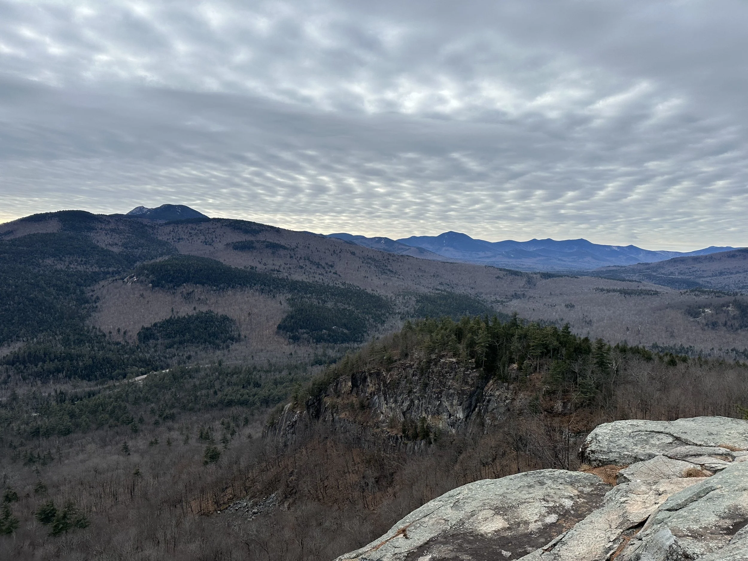
Mount Eisenhower
Length: 6.3 miles round trip
Elevation Gain: 2,800 feet
Things to Know: The road leading to the trailhead is not paved.
Mount Eisenhower is among the tallest mountains in New Hampshire, offering stunning 360-degree views. It is one of my favorite hikes in Crawford Notch!
The hike to Mount Eisenhower begins on Edmands Path, which is a gradual and steady climb. The trail is not overly technical, but it is a steady climb to the summit, making you work for its views. As it approaches the summit, the trail comes out of the treeline, offering stunning views of the Presidentials.
Thanks to its bald summit, Mount Eisenhower offers breathtaking views of the surrounding mountains. Mount Washington is only a few miles away, so you will have incredible views of it (if it is out of the clouds, of course).
Mount Pierce
Length: 6 miles round trip
Elevation Gain: 2,400 feet
Things to Know: Mount Pierce is one of the most popular hikes in the White Mountains, and I recommend arriving at the trailhead early to enjoy a more peaceful hike.
Mount Pierce is one of my favorite hikes because it offers stunning views of the Presidentials. I have hiked Mount Pierce countless times in every season, and it never disappoints.
The trail is not overly technical as it gradually and steadily climbs to the summit of Mount Pierce. Although the trail does not offer views until it reaches the summit, it is beautiful with a moss-covered floor. It also passes the small but beautiful Gibbs Falls along the way.
Mount Pierce does not have 360-degree views, but that does not make them any less stunning! You will be in awe of the beautiful views from Mount Pierce and quickly realize why many (including myself) love it.
Mount Jackson and Mount Webster Loop
Length: 6.2 miles round trip
Elevation Gain: 2,200 feet
Things to Know: This trail has rock scrambles as you approach the summits.
The Mount Jackson and Mount Webster Loop is a fun and challenging hike that offers stunning views of the Presidentials. Mount Jackson is one of my favorite hikes in the area because I love its fun rock scrambles and incredible views.
The Webster-Jackson Trail gradually and steadily climbs from start to finish before becoming very steep as it approaches the summits. Once you get to the loop junction, you can go left to Mount Jackson or right to Mount Webster. You can hike to either summit first, but I tend to hike clockwise.
No matter which summit you hike to first, you will need to do some rock scrambling as the trail approaches the summits. I love rock scrambling, which is why I love this hike so much! And once you arrive at the summits, you are rewarded with breathtaking views.
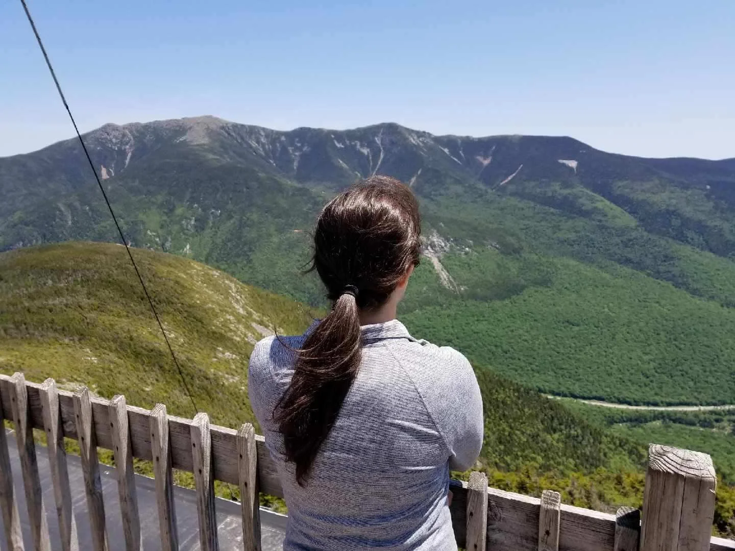
Mount Lincoln and Mount Lafayette Loop
Length: 8.5 miles round trip
Elevation Gain: 3,900 feet
Things to Know: This hike is one of the most popular in the White Mountains, but it is not easy. It has many steep sections leading to the ridge, and once you are on the ridge, you are exposed to the elements for over 1.5 miles.
Parking Information: The trailhead parking lot fills up quickly, and on weekends, it is full before 8 AM. If the lot is full, you can take a hiker shuttle from Cannon Mountain. The shuttle is only available from the end of May through October.
The Mount Lincoln and Mount Lafayette Loop (otherwise known as the Franconia Ridge Loop) is among the most hiked trails in New Hampshire. The views along the ridge are spectacular and always take my breath away (from the views and the effort it takes to get there, haha). But it is not an easy hike, so as with any hike, do proper research to ensure you are prepared with the correct gear and experience.
Although you can hike the loop in either direction, I recommend going counterclockwise, ascending Falling Waters Trail. Falling Waters Trail right out of the gate steadily climbs, offering minimal breaks. It also has multiple river crossings that are tricky when the water is high. You will also pass the stunning Cloudland Falls on the ascent, which is a nice bonus!
Once you reach the ridge near Little Haystack Mountain, you are rewarded with breathtaking 360-degree views. The next 1.5 miles to Mount Lincoln and then Mount Lafayette are above the treeline, allowing you to enjoy the beautiful views as you make your way across.
Once you pass Mount Lafayette, the Greenleaf Trail begins to descend, still offering incredible views of Franconia Notch before it heads into the treeline. You can also stop at the AMC Greenleaf Hut for a break or to buy some food before continuing the steady descent back to the parking lot.
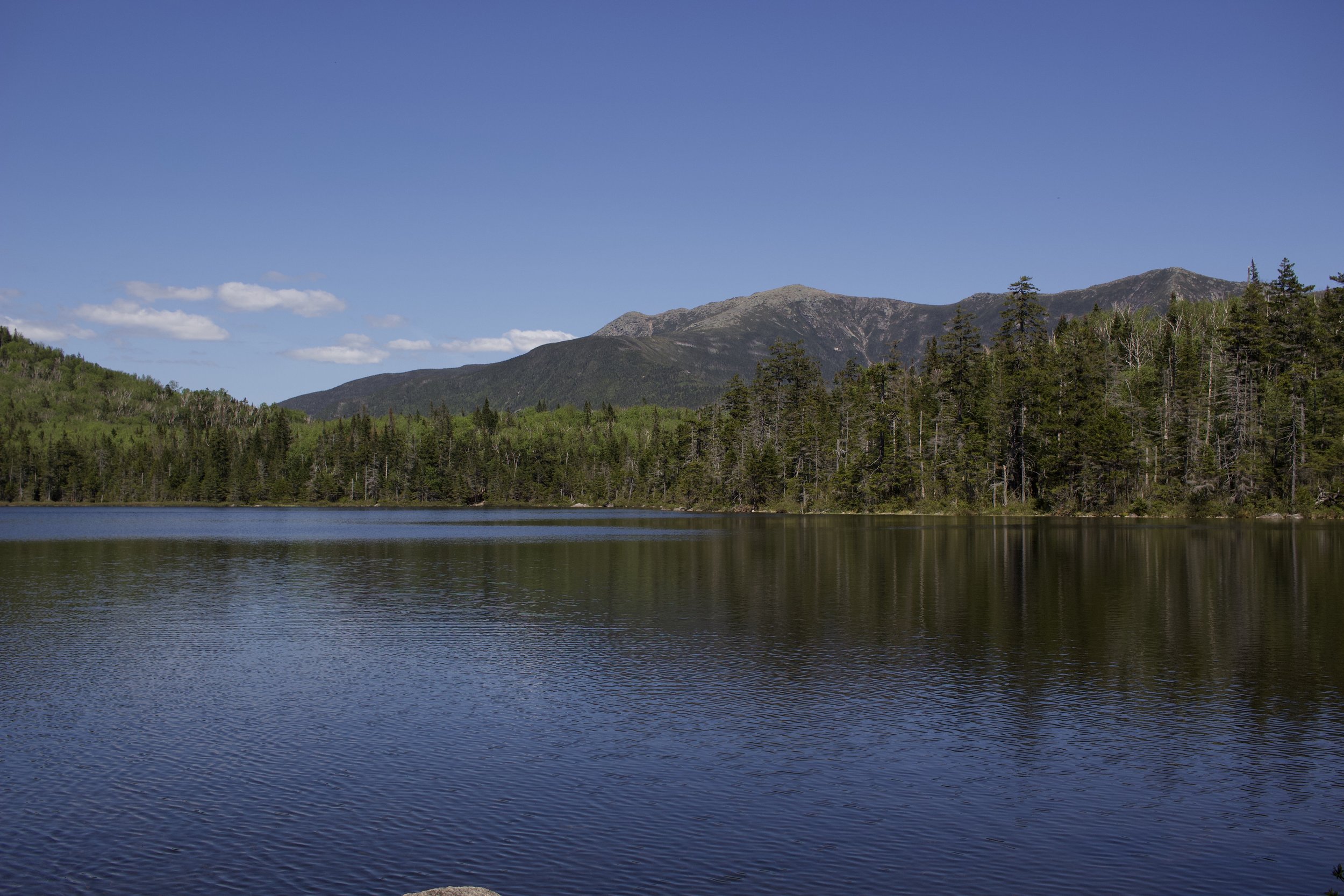
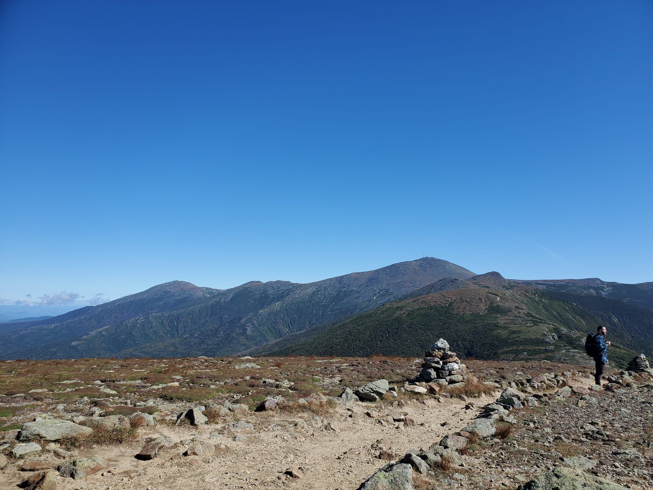
Mount Washington
Length: 9.2 miles round trip
Elevation Gain: 4,000 feet
Things to Know: Mount Washington has many trails leading to its summit, and none of them are easy. Please do your research to ensure you are prepared with the proper gear and experience before heading out.
Mount Washington is the tallest mountain in New England, making it a bucket list hike for many people. I have hiked Mount Washington a few times up various routes, and it is always a fun but challenging hike!
As I mentioned, Mount Washington has many trails to its summit. The most popular are the Tuckerman Ravine Trail and Jewell Trail, and both are strenuous, gaining over 4,000 feet of elevation. I have hiked both, and I would say Jewell Trail is more gradual, but Tuckerman is more scenic. Either way, you will be working hard for those views!
Before you head out, make sure to check the Mount Washington Observatory forecast. They have a 2-day forecast for the higher summits and current summit conditions for Mount Washington. It is an incredible resource I always use when planning a hike.
If you are looking for the best hikes in the White Mountains, you are in the right place! This guide has everything you need to know about fun hikes for all levels.

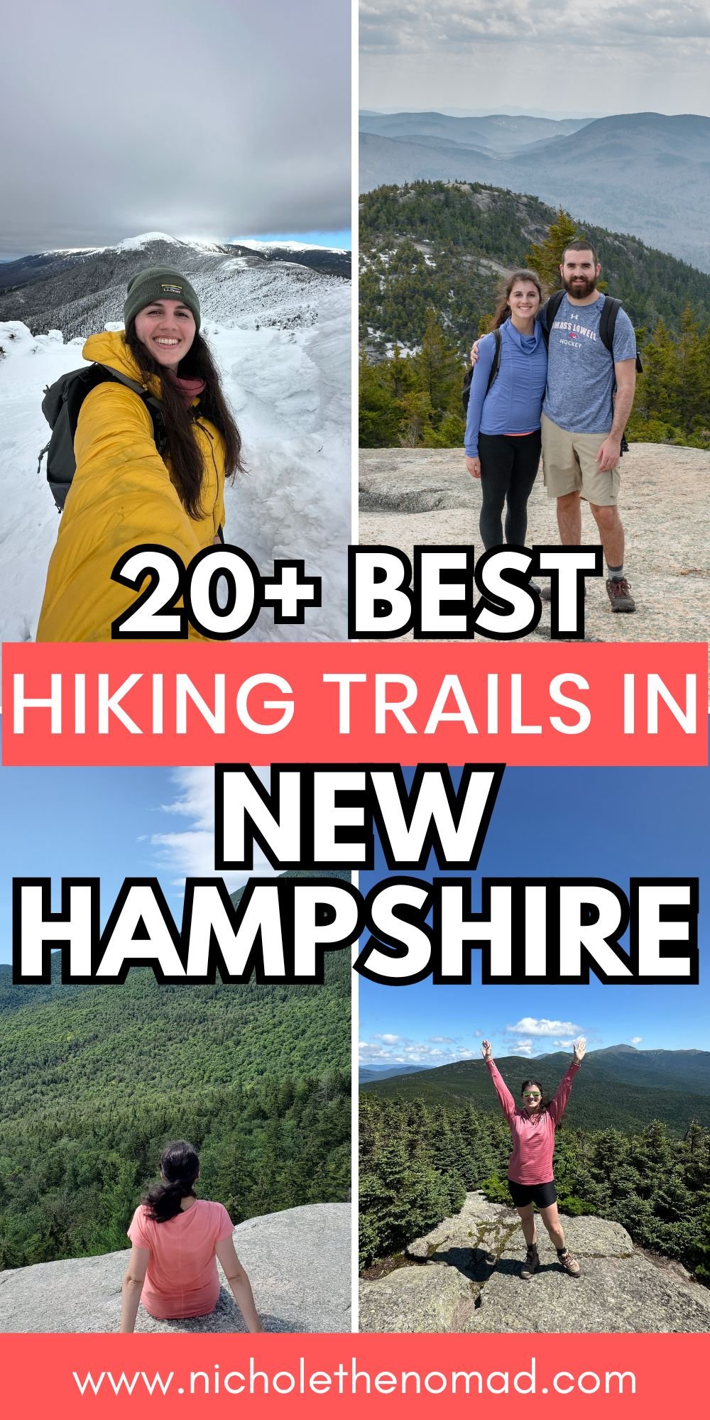
Hey, I’m Nichole!
I am the creator behind Nichole the Nomad, the home of my explorations around the world, mountain hikes, and beautiful pictures taken along the way. I have a deep passion for capturing the world in a beautiful light and sharing my experiences.
I created this blog to share my travels, show how beautiful the world is, provide tips and tricks for traveling, and encourage you to explore. Whether you want to travel across the world or explore what’s in your backyard, I hope this blog inspires you to get outside and find your adventure!
Pin it for later!