
Wildcat D, Wildcat A, Carter Dome, South Carter Mountain, Middle Carter Mountain, and Mount Moriah

Disclaimer: This post contains affiliate links. If you click through and make a purchase, my blog may receive a commission at no additional cost to you.
Wildcat-Carter-Moriah Traverse Overview
The Wildcat-Carter-Moriah Traverse is an epic and strenuous hike that will test you mentally, emotionally, and physically. The 21-mile traverse goes over six peaks that are on New Hampshire’s 48 4,000 footer list: Wildcat D (4,050’), Wildcat A (4,422’), Carter Dome (4,832’), South Carter Mountain (4,430’), Middle Carter Mountain (4,610’), and Mount Moriah (4,049’). The Wildcat-Carter-Moriah Traverse can be completed in a (long) day or as an overnight, staying at the Carter Notch Hut or Imp Shelter.
Trail Details
Trail: Lost Pond Trail > Wildcat Ridge Trail > Carter-Moriah Trail
Length: 21 miles (**GaiaGPS and AllTrails showed this as 17 miles, but the guidebook and signs along the trail totaled 21 miles. We also had a detour because of trail work, which made the hike longer.)
Elevation Gain: 6,600 feet
My Trail Time: 11:30 hours hiking, 13 hours total
Hike Overview
The Wildcat-Carter-Moriah Traverse is one of the most difficult hikes I have completed. The 21-mile trail gains almost 7,000 feet of elevation, most of which is gained at the beginning of the hike. If you plan on completing the Wildcat-Carter-Moriah Traverse as a day hike, I recommend starting as early as possible. This hike is an all-day adventure. Also, this is a point-to-point trail, so it requires having two cars.
Looking to track your hikes while completing the New Hampshire 4,000 Footer List?
Whether this is your first or tenth time completing the list, this journal is designed to help you track, reflect, and celebrate each summit!
Each journal includes:
- individual pages for each mountain
- space to log stats about the hike
- sections to journal about your favorite moments
- completion tracker to celebrate your progress
- and fun extras like Hiking Bingo!

Wildcat-Carter-Moriah Traverse Guide
September 12, 2020
**Always remember to leave no trace. It is crucial to pack out what you pack in and throw away your trash properly.
Chelsea and I began this crazy traverse at 7:30 AM on a beautiful and crisp September morning. The Wildcat-Carter-Moriah Traverse usually begins at the Glen Ellis Scenic Area, but the portion of the trail heading to Glen Ellis Falls was closed for trail maintenance. We instead had to add a mile onto our hike and begin on the Lost Pond Trail, which begins across from the Pinkham Notch.
The first mile on Lost Pond Trail was uneventful and relatively flat, which we were appreciating and using as a warmup for the long day of hiking we had ahead of us. After a mile, we arrived at the Wildcat Ridge Junction, and the real ascent began. We turned left to continue on the Wildcat Ridge Trail and gained over 1,500 feet of elevation in under two miles. It was a tough climb, but we were on fresh legs, so it wasn’t as bad as we thought it would be.

Before we knew it, we arrived at the top of the Wildcat ski slopes. While we were on the slopes, we saw Wildcat D straight ahead of us. We continued the short but steep ascent to Wildcat D, climbed onto the small viewing platform, and took a break to take in the views.

As we were finishing our snacks and celebrating our first 4,000 footer of the day, we met two Appalachian Trail thru-hikers! Most of the Wildcat-Carter-Moriah Traverse follows along the Appalachian Trail, so we were excited to meet thru-hikers along our journey. From Wildcat D, we continued on the Wildcat Ridge Trail for another few miles until we arrived at Wildcat A. There is a small overlook on Wildcat A that offered great views of the White Mountains. We knew one of the most difficult parts of the traverse was coming up, so we took a short break on Wildcat A before heading back to the Wildcat Ridge Trail.

After Wildcat A, the Wildcat Ridge Trail begins to descend steeply for a mile until the Carter Notch Hut. We went to the Carter Notch Hut but quickly realized we went too far. The Carter-Moriah Trail diverged from the trail leading to the Carter Notch Hut after we rounded the small pond. We took a quick snack break at the hut before continuing to what would be the most difficult section of the Wildcat-Carter-Moriah Traverse.
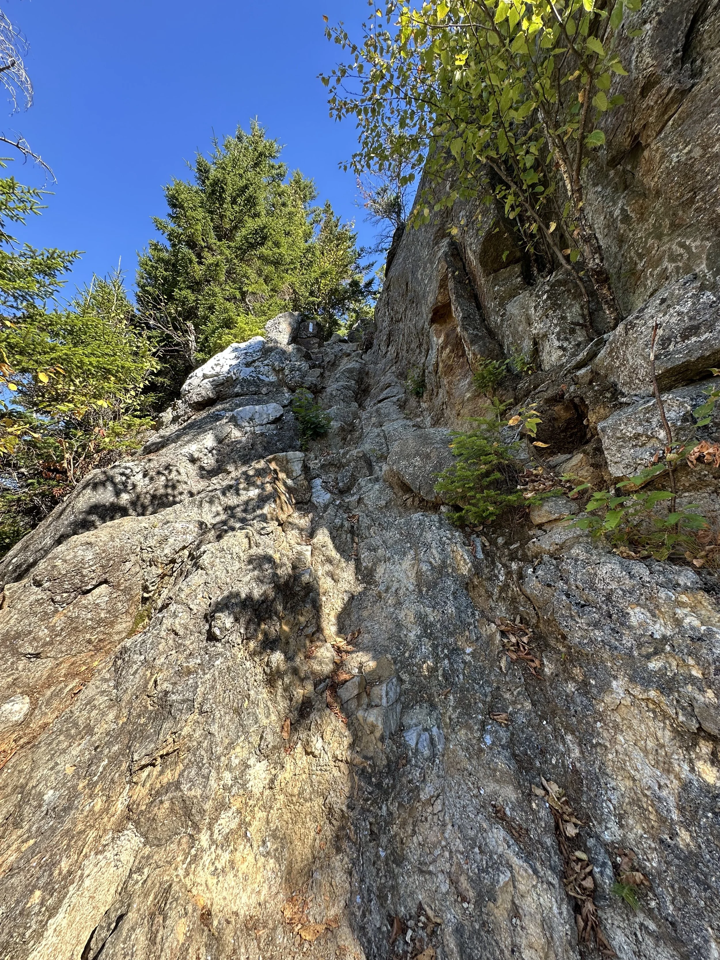
The climb to Carter Dome was BRUTAL. The Carter-Moriah Trail to Carter Dome gained about 1,500 feet of elevation in a mile. The trail was very steep and exhausting, and it took us an hour to reach Carter Dome. I’m not going to lie, we were pretty miserable during this section of the trail. On a happier note, we met another Appalachian Trail thru-hiker! He was awesome to talk to, and we even took a selfie with him! After what felt like forever, we finally arrived at the summit of Carter Dome.
Carter Dome’s summit did not have a view, but there was a view from a lookout near the summit. We plopped down next to the rock cairn marking the summit and took a long and much-needed break. We ate our lunch and talked about how much longer we still had to go. Every time we talked to another hiker about the traverse we were completing, their eyes bugged out of their head. It did not help with our morale, but at the same time, it fueled us with fire to complete it.


After a lovely break eating our lunch and fueling up, we continued hiking on the Carter-Moriah Trail to South Carter Mountain and Middle Carter Mountain. The trail to the Carters was pleasantly not as steep as the trail had been, which we loved. We passed the junction to Mont Hight, which everyone said to go to, but we just wanted to complete the Wildcat-Carter-Moriah Traverse as quickly as possible because the day was flying by.
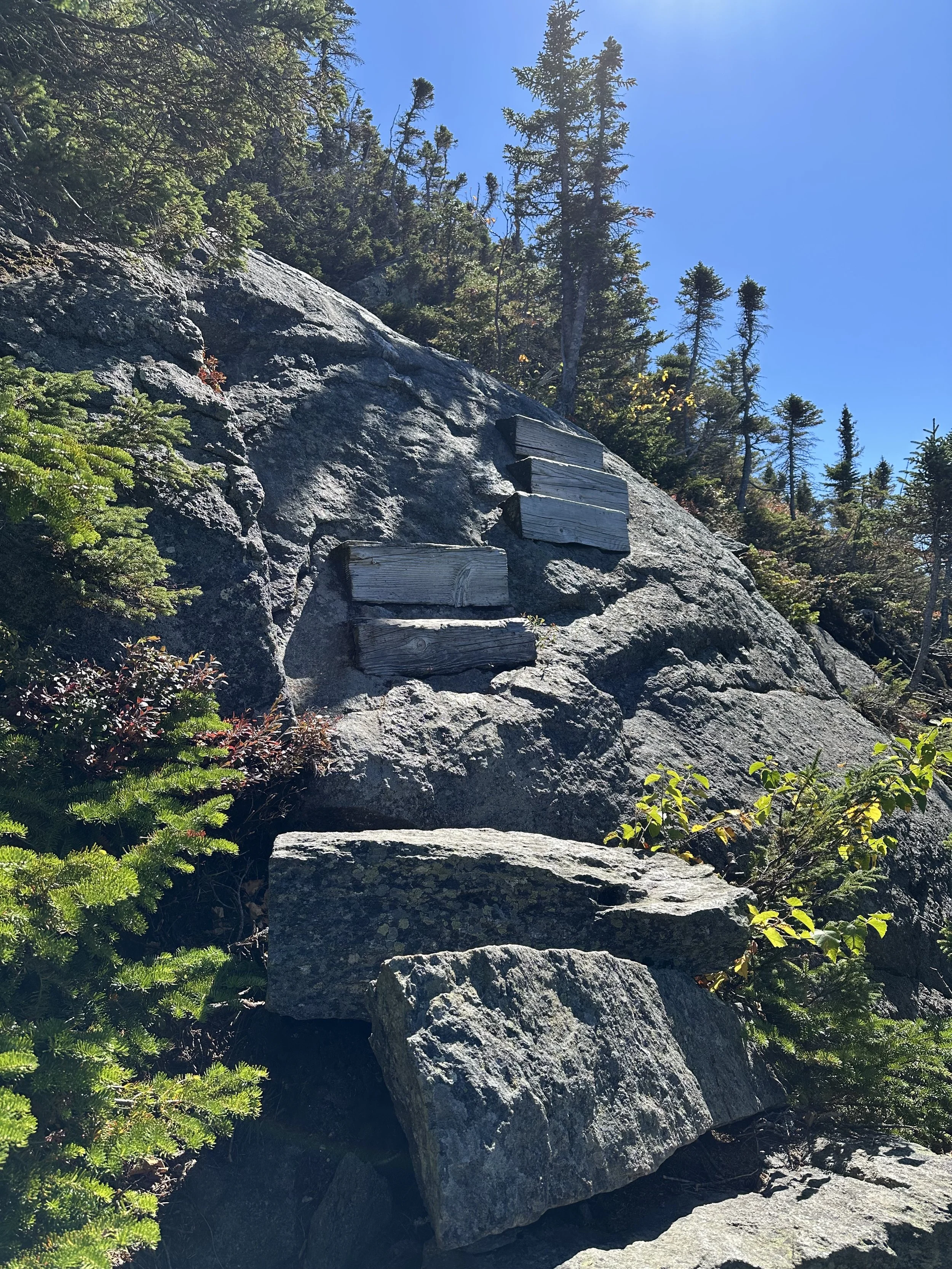
We passed over South Carter Mountain and Middle Carter Mountain, only stopping quickly to take a photo with the summit sign. We met a few other Appalachian Trail thru-hikers and stopped to have quick conversations with them, which was fun! The trail went in and out of the treeline, so we were rewarded with some views, which was nice! And before we knew it, we were descending towards the Imp Shelter. The rest of the trail had rock slabs, so our quads were ON FIRE! We conquered rock slab after rock slab until we reached the Imp Shelter junction. We decided to take one final break to refuel before completing the final stretch of the Wildcat-Carter-Moriah Traverse.
We expected the hike to Mount Moriah to be very steep, and it was steep, don’t get me wrong, but it wasn’t as bad as we anticipated. We ascended more rock slabs with our heads down and kept pushing until we reached Mount Moriah’s summit! Mount Moriah had a beautiful view from its summit, which we wished we could have spent more time on, but the sun was beginning to set, so we knew we didn’t have time. We took a quick photo on Mount Moriah’s summit before continuing on the Carter-Moriah Trail to begin our final descent.

The descent from Mount Moriah seemed neverending. The entire descent had with rock slabs, so we weren’t moving as quickly as we wanted to. After what felt like forever, we reached the summit of Mount Surprise, where we watched the sunset. We knew the last two or so miles would consist of us hiking in the dark, so we wanted to enjoy the sunset before continuing our descent on the Carter-Moriah Trail.

The final stretch of this hike felt so long. I think it was a combination of us being tired and having to hike in the dark. Luckily, I brought my headlamp, so we were okay to hike in the dark, although we stopped every few minutes to scan the forest. We passed someone who was probably innocently taking a break on the trail, but we were spooked and decided to run the last mile of the Carter-Moriah Trail. We burst through the trees and were SO happy to complete the Wildcat-Carter-Moriah Traverse.
I’m not going to lie, I underestimated the Wildcat-Carter-Moriah Traverse, and I think it was because GaiaGPS and AllTrails said it was only 17 miles. I’m convinced the AMC Guidebook is correct in stating the traverse is 21 miles. Either way, the Wildcat-Carter-Moriah Traverse is a long and grueling hike. It’s a great way to check off six 4,000 footers, but I would never do it again.
Have you or would you hike the Wildcat-Carter-Moriah Traverse?

Hey, I’m Nichole!
I am the creator behind Nichole the Nomad, the home of my explorations around the world, mountain hikes, and beautiful pictures taken along the way. I have a deep passion for capturing the world in a beautiful light and sharing my experiences.
I created this blog to share my travels, show how beautiful the world is, provide tips and tricks for traveling, and encourage you to explore. Whether you want to travel across the world or explore what’s in your backyard, I hope this blog inspires you to get outside and find your adventure!