Hiking the Laugahraun Loop in Landmannalaugar Iceland
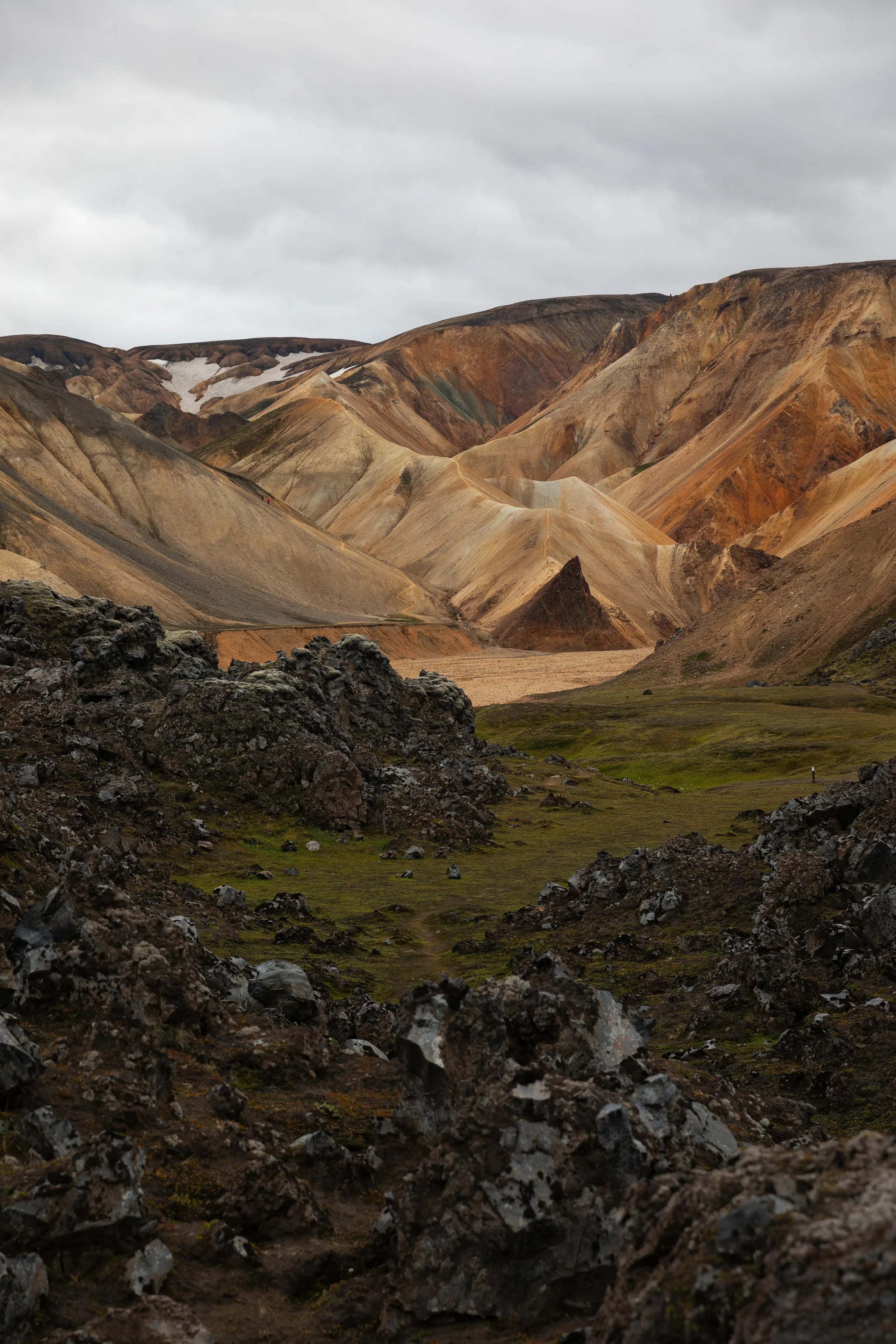
Landmannalaugar is one of the most beautiful areas in the Iceland highlands and one of my favorite places to visit in Iceland. It has multi-colored mountains, lava fields, and geothermal areas. And the best part? You can get an up-close and personal experience with its views by hiking.
I have visited Landmannalaugar twice because it is one of those places that will never get old. The first time we visited, it was raining, and we decided not to hike, but the second time, we hiked the entire day around its trail system.
Although Landmannalaugar has many trails, one of the best is the Laugahraun Loop. It is one of the easier trails and offers breathtaking views as you travel through the lava fields. If you want to plan a hike along the loop, you are in the right place! This guide has everything you need to know about hiking the Laugahraun Loop.
Disclaimer: This post contains affiliate links. If you click through and make a purchase, my blog may receive a commission at no additional cost to you.
Laugahraun Loop Overview
Trail Length and Difficulty
The Laugahraun Loop is one of the easiest and shortest hikes in Landmannalaugar. The 3-mile loop gradually gains about 600 feet of elevation and travels through lava fields and along the base of the surrounding multi-colored mountains.
The best part about the Laugahraun Loop is you can easily extend it if you want a more strenuous day hike. Landmannalaugar has many interconnecting trails, allowing you to make the hike longer and climb some of the mountains in the area, including Brennisteinsalda and Blahnukur. But if you are only looking for a short and sweet hike to enjoy the stunning views in Landmannalaugar, the Laugahraun Loop is perfect.
Trailhead Parking
The trailhead parking is near the Landmannalaugar Tourism Information Center and the campground off F224. Just before the campground, the road crosses a deep river. I recommend parking just before the river and crossing the pedestrian bridge because we have seen many cars get stuck in the river.
Once you are parked and walked toward the information center, you will see signs pointing to the trailhead. The trailhead also has a map showcasing the trails in the area to make it easier for you.
How to Get to Landmannalaugar
Although there are multiple ways to get to Landmannalaugar, I recommend driving from the north because it is the easiest and does not have river crossings. No matter which road you drive, a 4x4 approved for F roads is required. F roads are unmaintained mountain roads with anything from rocks to river crossings.
You can take F26 to F208 and head right into Landmannalaugar pretty easily. F26 is a paved road, but F208 is mostly unpaved. The road is well-maintained compared to when we visited our first time, but it is still very rocky, and you should use caution when driving it.
As I mentioned above, the road crosses a river just before the campground in Landmannalaugar. I recommend parking in the lot before the river crossing and walking over to the trails.
Other Hikes near the Laugahraun Loop
As I mentioned above, Landmannalaugar has many beautiful trails. You can add them to this loop or hike them separately. Each trail offers incredible views, and you will not be disappointed no matter what you choose to hike.
Laugahraun, Brennisteinsalda, and Blahnukur Loop: 7-mile loop around the best viewpoints
Brennisteinsalda Loop: 5.6-mile loop to the top of Brennisteinsalda
Blahnukur Loop: 4-mile loop to the top of Blahnukur
What to Pack for Hiking in Landmannalaugar
The Iceland highlands are known to have unpredictable weather. When we visited for the first time, the day started sunny without a cloud in the sky, but it quickly turned into a torrential downpour. You should pack layers and rain gear, especially if you want to hike.
You should have hiking boots, moisture-wicking clothes, rain jacket, and a hiking backpack with food and plenty of water.
Guide to Hiking Laugahraun Loop
**Always remember to leave no trace. It is crucial to pack out what you pack in and throw away your trash properly. It is also crucial to only hike on the designated trails to avoid damaging restoration areas and fragile vegetation.
The Laugahraun Loop is one of the easier hikes in Landmannalaugar, offering incredible views of lava fields and multi-colored mountains. If you are looking for a short and sweet hike, it is the perfect trail!
The loop begins just past the information center, and you can hike it in either direction. I recommend following it counterclockwise, which is what we did, and I loved doing it that way!
The first section of the Laugahraun Loop travels through a really cool lava field before bringing you to an open view of the surrounding mountains. The views along this portion of the trail are breathtaking, and you get incredible views of the multi-colored mountains.
The trail flattens out as it continues through the lava field, with multiple viewpoints. Although the entire trail has beautiful views, I recommend stopping at each viewpoint to take it all in.
The Laugahraun Loop curves left and intersects with a trail leading into the nearby field. You want to continue left to stay on the loop and begin hiking to the geothermal area.
The next section of the loop is the steepest, but it is short and brings you to the base of Brennisteinsalda. I loved this portion of the trail because the views of Brennisteinsalda are stunning!
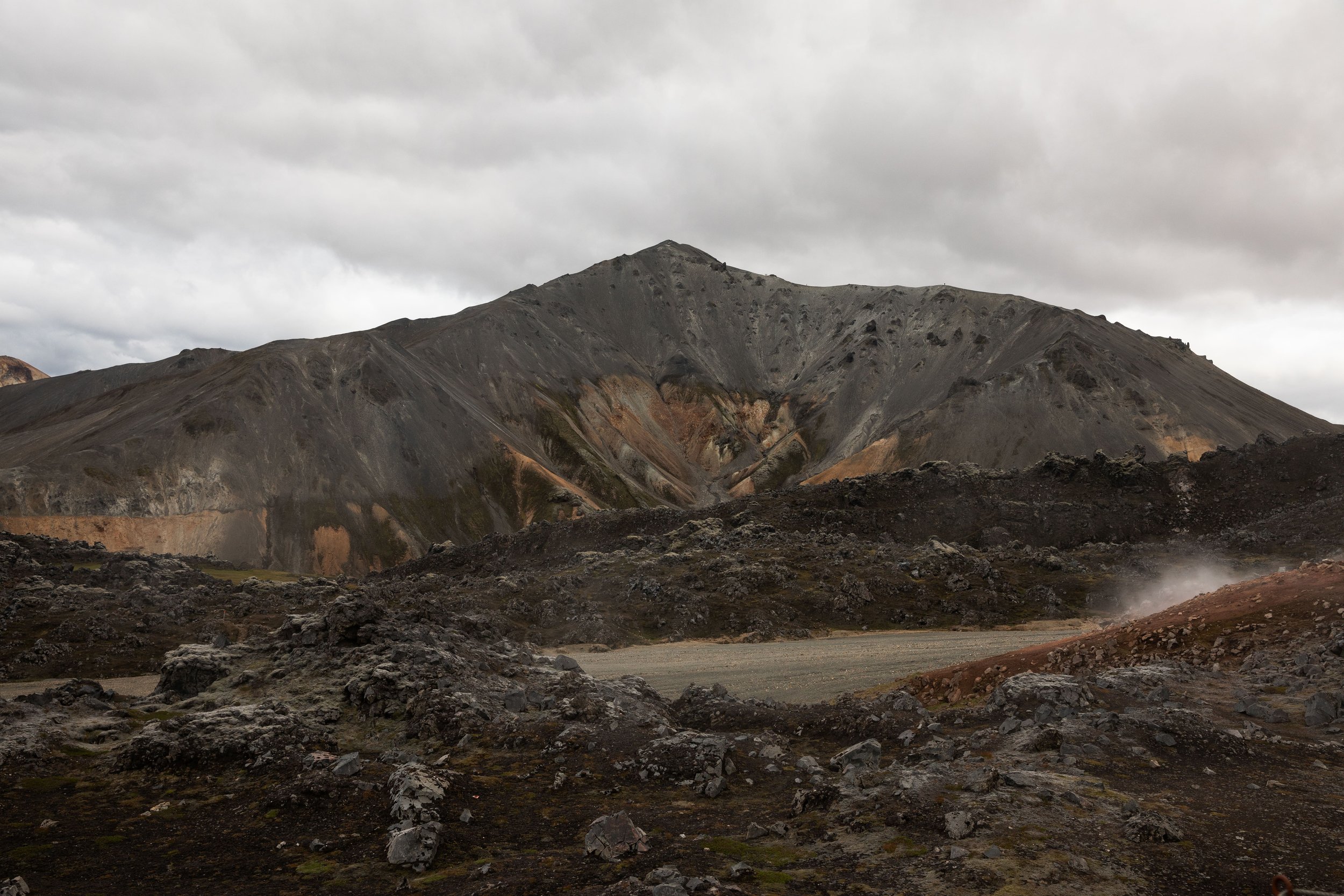
Once you are at the base of Brennisteinsalda, the trail passes through a geothermal area. Although the sulfur is not the best-smelling thing along the trail, this area is stunning and absolutely worth a stop to enjoy!
This section of the trail also intersects with the trail leading to the summit of Brennisteinsalda, but you want to continue left to stay hiking on the loop. Along this section, you travel through more lava fields with views of Blahnukur, one of the most popular mountains to summit in Landmannalaugar. I also recommend turning around to enjoy the views of the mountains behind you!
The rest of the loop was a bit difficult to follow when we hiked it, but we had a map that helped us stay on the trail. This area has a few spots that look like trails but are not, making it crucial to pay attention to where you are hiking.
Soon enough, the trail travels along the base of Blahnukur and intersects with its popular trail. You want to continue left towards the parking lot. This section of the loop also offers beautiful views of multi-colored mountains in the distance, which we loved! It felt like you could see for miles towards the mountains.
Finally, you will see the campground and mountain mall where you started the hike. If you are hungry after your hike, I recommend checking out the Mountain Mall because they have snacks and a small food menu. We loved stopping here after our hike!
If you are looking for one of the easier hikes in Landmannalaugar, the Laugahraun Loop is for you! This guide is the perfect place to plan your hike before you visit.
Hey, I’m Nichole!
I am the creator behind Nichole the Nomad, the home of my explorations around the world, mountain hikes, and beautiful pictures taken along the way. I have a deep passion for capturing the world in a beautiful light and sharing my experiences.
I created this blog to share my travels, show how beautiful the world is, provide tips and tricks for traveling, and encourage you to explore. Whether you want to travel across the world or explore what’s in your backyard, I hope this blog inspires you to get outside and find your adventure!
Pin it for later!


